Observation Date
1/15/2016
Observer Name
Joey Dempster
Region
Salt Lake » Snake Creek
Location Name or Route
Snake Creek
Weather
Sky
Overcast
Precipitation
Light Snowfall
Weather Comments
Calm winds at mid elevations.
Snow Characteristics
New Snow Depth
8"
New Snow Density
Low
Snow Surface Conditions
Powder
Snow Characteristics Comments

6-8 inches of new snow overnight. Very light density. New snow fell on variety of snow surfaces, including weak facets in sheltered areas to supportable melt-freeze crusts on southern exposures.

Avalanche Problem #1
Problem
New Snow
Problem #1 Comments

The new snow sluffed easily today. I wasn't in terrain where it was a problem, but on longer pitches, the new snow could have sluffed enough to pack a punch. The air was warm though, so I would expect that to be less of a problem on Saturday. Still, caution is advised in steep terrain.

Avalanche Problem #2
Problem
New Snow
Problem #2 Comments

In this case, I am referring to a future storm slab, assuming that it will continue to snow tonight and tomorrow. Friday's new snow and the old surface facets are very low density and comprise a layer 40-50 cm deep, providing ample weakness if stronger snow is deposited on top of it by precip or wind. I think these layers will heal fairly quickly, but it cannot be overstated how weak they are currently.

Snow Profile
Aspect
Northeast
Elevation
8,400'
Slope Angle
37°
Comments

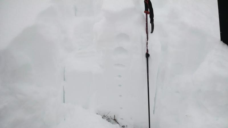
There is a lot of Fist strength (weak) snow at the top of the snowpack, and only 20cm of it is new. The rest is decomposing snow that has not gained strength yet and facets from the post-new year's quiet period.

ECTX further indicates that the danger from basal facets is mostly passed. Poking around in this layer confirmed that the facets have knitted themselves together in most spots, except where there are large voids caused by vegetation.

CPST was inconclusive as I could not get the saw cleanly through the vegetation, but anecdotally I did not observe any propensity to propagate.

I'm calling Friday's hazard moderate only for the sluffing. There was low danger of slab avalanches in the mid elevation terrain I observed. Tomorrow will be the same mix, unless a significant density inversion occurs in any further snowfall, or in areas where wind deposits snow on the low density new snow or old surface facets. In this case, hazard will climb to considerable.

Today's Observed Danger Rating
Moderate
Tomorrows Estimated Danger Rating
Moderate
Coordinates