Observation Date
1/14/2016
Observer Name
Greg Gagne
Region
Salt Lake » Little Cottonwood Canyon
Location Name or Route
Upper LCC Perimeter
Weather
Sky
Overcast
Precipitation
Light Snowfall
Wind Direction
West
Wind Speed
Moderate
Weather Comments
Moderate westerly winds that seemed confired to 10,000' and above. Very pleasant -10C temps. About a 10 min sucker hole mid-day, otherwise generally poor visibiity.
Snow Characteristics
New Snow Depth
4"
New Snow Density
Low
Snow Surface Conditions
Powder
Wind Crust
Snow Characteristics Comments

New snow was sluffing very easily on slopes approaching 35 degree and steeper. There seemed to be a weakness within the storm snow, but sluffs generally ran down to the old, faceted snow surface. Sluffs were shallow, but running fast and far. On South and West aspects am finding the snow to have a decent bond to the old surface that had crusted, but there really wasn't much of a storm slab to adequately test this.

Red Flags
Red Flags
Wind Loading
Cracking
Poor Snowpack Structure
Red Flags Comments
Was getting widespread cracking in the storm snow, especially along the ridgelines where the winds deposited more snow. Am identifying poor snowpack structure as the preserved layer of near-surface facets now buried 10cm (4") down.
Avalanche Problem #1
Problem
New Snow
Trend
Increasing Danger
Problem #1 Comments

Storm slab resting on preserved layer of NSF. Currently not much of a slab on top, but the old snow surface is pretty weak so it will be sensitive to any additional loading from snow and/or wind. Thursday afternoon Cottonwood forecast update is calling for moderate westerly winds with about 0.5" of water, so this may be enough to make this layer active.

Comments

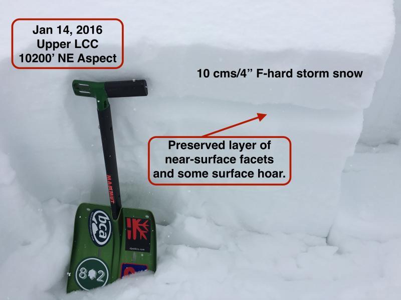
I have really been influenced by Drew Hardesty's focus on identifying your avalanche problem, and then determining how it can be managed. Today it is pretty clear that the old snow surface faceted over the past several days, so the current avalanche problem is this layer is preserved and there is now a shallow, soft slab on top. Currently this isn't much of a problem and the hazard is managed easily (and should I say also quite fun) with ski cuts. Today I was able to easily get several sluffs and shallow soft slabs to run on the old snow surface on slopes steeper than about 35 degrees. I was finding the old snow surface to be especially weak on NW through E aspects.

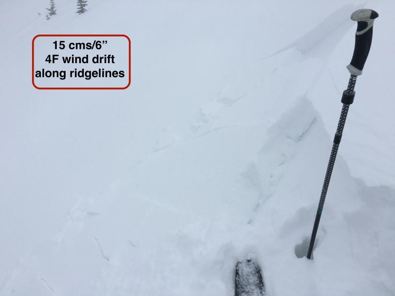
Currently there isn't much of a slab on top, so although sluffs were common, they were also very easy to manage and mitigate. With additional snow and wind in the forecast, things may be especially touchy by Friday morning.

The old snow surface is mostly near-surface facets, although some surface hoar is also present, but it is not widespread where I was looking. Over the next several days I would pay particular attention to shady mid-elevation slopes where the surface hoar may have been better preserved.

Video is snowpack discussion focusing on the layer of preserved NSF.

Video

Video showing results of ski cut.

Video
Today's Observed Danger Rating
Moderate
Tomorrows Estimated Danger Rating
Moderate