Join us at our 2nd Annual Blizzard Ball

Observation: Abajo Mountains

Observation Date
1/9/2016
Observer Name
Brian Sparks
Region
Abajos » Abajo Mountains
Location Name or Route
Ridge above ski area
Weather
Sky
Overcast
Precipitation
Light Snowfall
Wind Direction
North
Wind Speed
Light
Snow Characteristics
New Snow Depth
10"
New Snow Density
Low
Snow Surface Conditions
Powder
Red Flags
Red Flags
Heavy Snowfall
Wind Loading
Avalanche Problem #1
Problem
Wind Drifted Snow
Trend
Decreasing Danger
Problem #1 Comments
North winds have transported snow to southerly aspects. Winds slowed throughout the day.
Avalanche Problem #2
Problem
Persistent Weak Layer
Trend
Decreasing Danger
Problem #2 Comments
Poor bonding between storm layers were reactive to compression but did not propagate.
Snow Profile
Aspect
Northeast
Elevation
10,500'
Slope Angle
38°
Comments
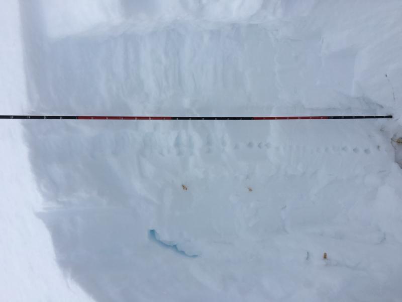
Thin weak layers at 130 and 110 cm depth sheared easily in shovel shear test and produced moderate results in compression test(CT13Q2, CT16Q2), and were reactive in extended column test but did not propagate(ECTN15Q2, ECTN20Q2).
Today's Observed Danger Rating
Moderate
Tomorrows Estimated Danger Rating
Moderate
Coordinates