Observation: Silver Fork

Observation Date
1/1/2016
Observer Name
Tyler Falk
Region
Salt Lake » Big Cottonwood Canyon » Silver Fork
Location Name or Route
Silver Fork
Weather
Sky
Clear
Wind Direction
Southeast
Wind Speed
Strong
Weather Comments
Strong winds from the southeast and clear skys in the afternoon.
Snow Characteristics
Snow Surface Conditions
Powder
Dense Loose
Wind Crust
Snow Characteristics Comments

Like Evelyn said in yesterdays forecast the winds were a spoiler for terrain not sheltered.

Red Flags
Red Flags
Recent Avalanches
Wind Loading
Cracking
Poor Snowpack Structure
Red Flags Comments
Cracking noticed on a variety of aspects. Wind loading noticed on West, South and North aspects. Still weak snow on the ground. A few new wind slabs noticed in my travels.
Avalanche Problem #1
Problem
Wind Drifted Snow
Trend
Same
Problem #1 Comments

Noticed primarily on West, South and North aspects with cross loading in many places. A few of these seamed like they stepped down into faceted snow.

Avalanche Problem #2
Problem
Persistent Weak Layer
Trend
Increasing Danger
Problem #2 Comments

Lower probability, high consequence situation still going on. I feel the next few days we might have a higher chance of triggering a persistent slab from a wind slab that steps down. The bridge in LCC and BCC seams stronger than that outside the cottonwoods. However I know a high amount of spacial variability exists out there. Like Cowboy said the other day "I am not ready to trust a bridge that may break."

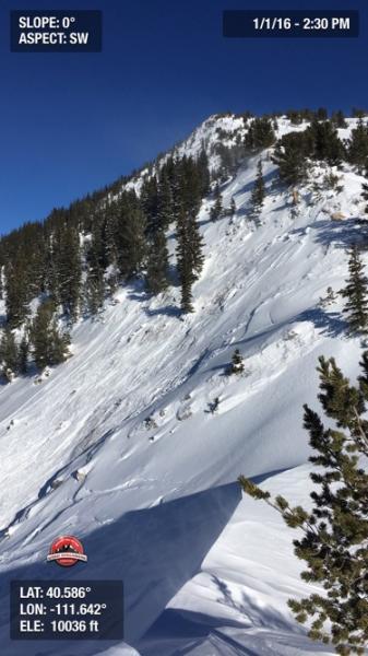
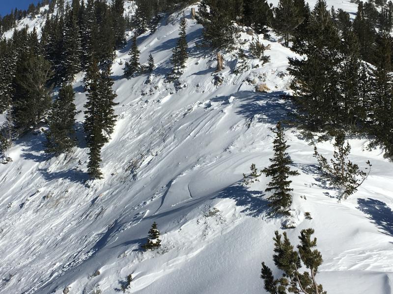
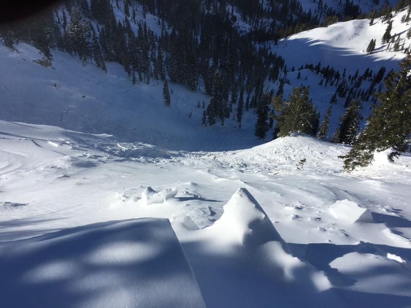
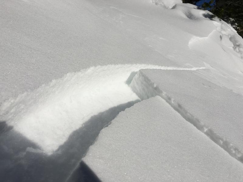
Pic 1, 2 & 3- East Bowl of Silver Fork. Unknown trigger. Came across at 2pm on Friday. Looks like it could have been either skier triggered or a natural cornice fall. Likely to be a windslab that possibly stepped down in places. Hard to tell timing due to the bed surface loading back in again. But would guess that it occurred in the late morning.

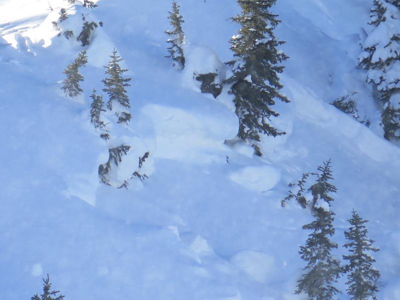
Pic 4- Older persistent slab avalanche.

Pic 5- Shallow 4" wind slab on South aspect

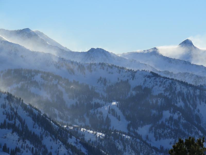
Pic 6-Snow Transporting on 11k ridge lines

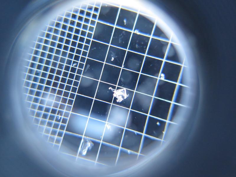
Pic 7- Facet on 3mm grid from 10k on a North aspect.

Today's Observed Danger Rating
Considerable
Tomorrows Estimated Danger Rating
Considerable