Observation: Summit Park

Observation Date
12/30/2015
Observer Name
C Brown
Region
Salt Lake » Parleys Canyon » Summit Park
Location Name or Route
Summit Park
Weather
Sky
Broken
Precipitation
Light Snowfall
Wind Direction
West
Wind Speed
Light
Weather Comments
Broken sky going to Overcast during observation precip going from S-1 to S1
Snow Characteristics
New Snow Depth
3"
New Snow Density
Low
Snow Surface Conditions
Powder
Snow Characteristics Comments

3-4" of light new snow, probably from the last 12-24 hrs.

Red Flags
Red Flags
Poor Snowpack Structure
Red Flags Comments
Shallow snowpack and the advanced depth hoar on the ground was concerning looking, but the moist 4F+ depth hoar was apearing to provide some stability.
Avalanche Problem #1
Problem
Persistent Weak Layer
Problem #1 Comments

Looking at the snow structure with the advanced striated crystals on the ground it was a concern, but due to them being moist it appeared to prevent the pack from failing on that layer.

Snow Profile
Aspect
Northeast
Elevation
8,100'
Slope Angle
30°
Comments

Looking at the snow structure with the advanced striated crystals on the ground it was a concern, but due to them being moist it appeared to prevent the pack from failing on that layer. There is a fairly stout crust existing above the depth hoar along with the decomposing rime crust and the shallow snow pack causing much of the pack to facet out. Other than the top foot of snow the rest seems to be moving away from rounding, towards a shallow faceted snow pack.

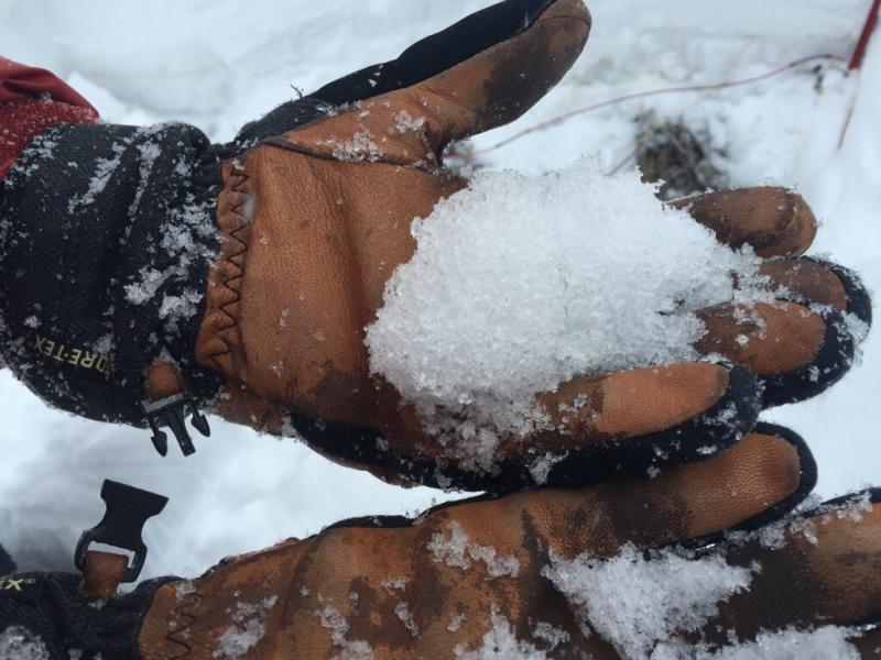
Moist semi chained up 2-3mm striated hollow cups.

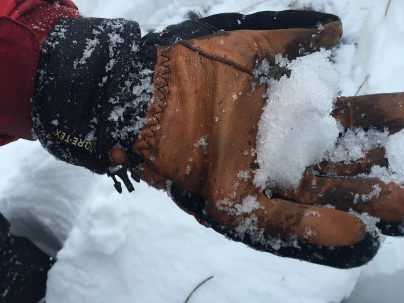
Could pack the depth hoar into a snowball, good sign they are wet. They also were denser/higher resistance than they looked.

Today's Observed Danger Rating
Moderate
Tomorrows Estimated Danger Rating
Moderate
Coordinates