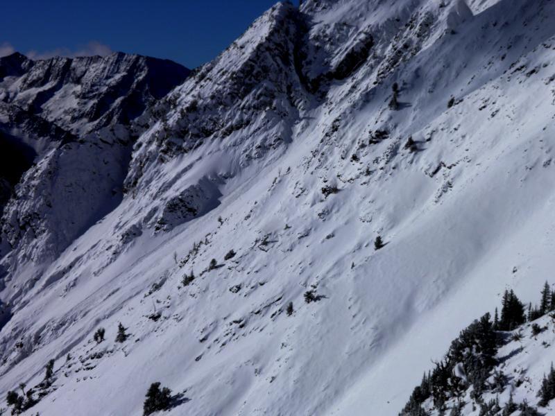
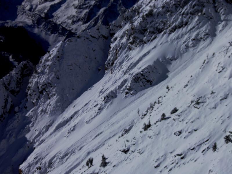
The new five inches of snow did not provide enough weight to change the avalanche conditions much, seems like the wind stopped blowing before most of the new snow fell so there didn't seem to be much of a problem with fresh wind slabs except for maybe some on the high ridge lines. Noted on fairly large {for this year} new snow slide on south facing Superior, looked like it ran about 1000ft, I'm assuming it ran on the slick melt freeze crust from yesterday and it didn't look like it broke into old snow from my vantage point. Also of noted was one pocket that pulled out in the rocks between Cardiac Bowl and Cardiac Ridge, kinda looked like it might have been an old wind slab from yesterday because it had the new snow covering it. Other than that the didn't appear to be a whole lot of action from this small storm, sluffs where not running far unless they were in super steep terrain. Snow pack structure still sucks for the most part, facets or facet crust sandwiches are abundant, just waiting for a slab to overload them, maybe Monday or Tuesday it's a waiting game right now. Photos: the new snow slide on Superior, no the best photos, I was in a hurry to go skiing.
Right now the wind is the only game changer I can think of, if it blows moderate for the high, steep wind exposed terrain, low in all other terrain.


