Observation: Uintas

Observation Date
12/9/2015
Observer Name
jg
Region
Uintas
Location Name or Route
Trial Lake/Notch Mountain
Weather
Sky
Broken
Wind Direction
Southwest
Wind Speed
Moderate
Weather Comments
Broken to overcast skies. Very light snow falling around 5:00. Winds were moderate to strong from the south with a westerly componet as the day went by. Very strong gusts on the ridges and in open terrrain. Winds moving snow. Mild temps, hovering around freezing at 10K+.
Snow Characteristics
New Snow Density
High
Snow Surface Conditions
Powder
Dense Loose
Wind Crust
Damp
Snow Characteristics Comments

Dense wind blown snow capping varying degrees of facets. Damp snow found at all elevations traveled.

Red Flags
Red Flags
Wind Loading
Cracking
Poor Snowpack Structure
Avalanche Problem #1
Problem
Wind Drifted Snow
Trend
Same
Problem #1 Comments

Still waiting for new snow but the wind keeps blowing and is forming wind slabs in open terrain and off the ridges on the lee side of terrain features. The wind was affecting snow well off the ridges today. Wind slabs were both stubborn and sensitive to the weight of a skier.

Snow Profile
Aspect
North
Elevation
10,500'
Slope Angle
35°
Comments

Snow profile was done on a wind loaded slope on a north facing aspect. The pack was deep here relative to most slopes hence the equitemperature nature of the pit. Most slopes are shallow and weak with a pronounced temperature gradient.

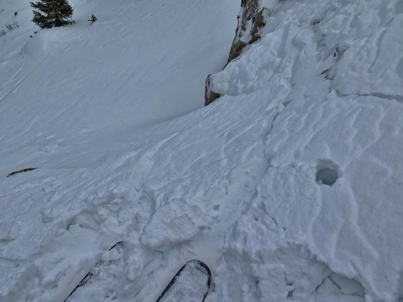
Still waiting for more water weight to tip the scales but the wind is creating sensitive slabs in some places. There just isn't that much snow to get people into terrain that they might find unstable. Low to moderate danger for the most part in the terrain traveled today. Moderate danger tomorrow if you are traveling in the wind zone and we do get some some snow overnight.

Today's Observed Danger Rating
Low
Tomorrows Estimated Danger Rating
Low