Observation Date
11/30/2015
Observer Name
Fred
Region
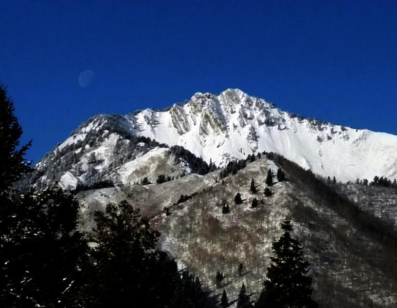
Salt Lake » Big Cottonwood Canyon » Mill D North
Location Name or Route
Mill D north fork
Weather
Sky
Clear
Wind Direction
West
Wind Speed
Moderate
Weather Comments
Cold clear day. Almost as if predicted wind picked up near noon. Blowing with some puropse on the ridgeline. After noon the highest peaks across the way (mt. superior, af twins twins) plumage or haze was observed. Trees were droping snow well below the ridge line as well. However wind was gusty not sustained.
It was chilly in the wind.
Snow Characteristics
New Snow Depth
4"
New Snow Density
Low
Snow Surface Conditions
Powder
Snow Characteristics Comments
Went to see just how bad the mid elevation conditions would be. Was not let down. That said low angel north facing was actual skiing. Other aspects are lacking coverage as well as portions of the route in and out.
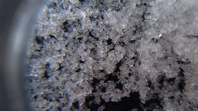
The obligatory pit just below the summit revealed total snow pack of perhaps 20". 4" or so of new light density snow sitting on a crust of maybe 1.5-2" with a large bed of facetted snow below that.
I did observe a large sluf of Mt. Raymond. Appears to be new snow only..
Red Flags
Red Flags
Wind Loading
Poor Snowpack Structure
Red Flags Comments
Really low danger in my area today. I would guess with the wind that there are some new pockets that could be active in high terrain on the lea slopes (east n. east)facing
Snow Profile
Aspect
North
Elevation
9,400'
Slope Angle
29°
Comments
snow pit
sluf on raymond
facets: You can just imagine a water droplet, not wanting to be stuck in a snow pack all season, waiting for the cool temps and low humidity and large temp. gradient to start to sublime outta here.
It could be interesting with the next major snow fall.
I rate the danger as low but as stated there are some wind pocket that will be active but manageable imo.
Today's Observed Danger Rating
Low
Tomorrows Estimated Danger Rating
Low
Coordinates