Observation: Meadows

Observation Date
11/20/2015
Observer Name
Toddeo
Region
Salt Lake » Big Cottonwood Canyon » Silver Fork » Meadows
Location Name or Route
Silver Fork - Meadows
Weather
Wind Direction
West
Wind Speed
Moderate
Weather Comments
Wind calmed down a bit in the afternoon. Enough of a breeze and low sun angle to keep southerly aspects dry. Enough wind to move grapuel around most of the day. Moderate in this typically sheltered area.
Snow Characteristics
New Snow Depth
3"
New Snow Density
High
Snow Surface Conditions
Dense Loose
Snow Characteristics Comments

A consistent 3" slathering of dense graupel all around. A lot of pooling on slopes below 35 degrees or so, up to a foot deep in place. Graupel was moving all day, at least an inch in my skintrack between the 1st and 2nd run.

A subtle and thin rain/rime crust at the base of the new snow, had to look hard to notice it. Graupel not present in some wind effected and steeper areas.

Red Flags
Red Flags
Wind Loading
Red Flags Comments
Wind was blowing most of the day. I was able to see airborne snow at varoius times, some drifting on the Silver/Days ridge with an occasional hard slab up to pencil density and supportable, thses were non-reactive. I would imagine the upper elevation tearrin is more wind effected. Low hazrd in this area, but I suspect the higher terrian is a different story.
Avalanche Problem #1
Problem
Normal Caution
Problem #1 Comments

Normal caution in this area, the main hazard is the thin snowpack (HS=14 to 18"), This is the thinnest snow pack that I have ever tried to ski in this area. I have a secret number that works and 14" is substantially less (sorry it is a secret...). Coneflowers should be knee-high in this area, currently waist high.

Snow is punchy with occasional punching through to the ground. I suspect that the new snow will set up overnight and help this situation.

Snow Profile
Aspect
East
Elevation
9,400'
Slope Angle
35°
Comments

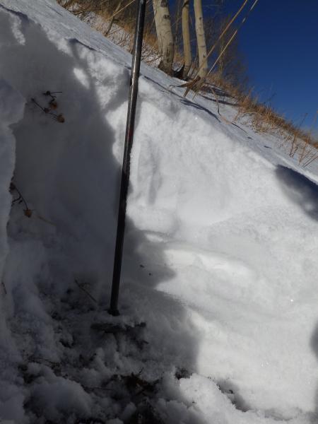
Snow profile is in 1st photograph. HST 3", HS 16. Of note:

Basel snow is damp, sub-millimeter grains.

Two sun crusts which are pencil density (isolated in photo).

Snow between the crusts is starting to facet but not to the point of a red flag.

Video

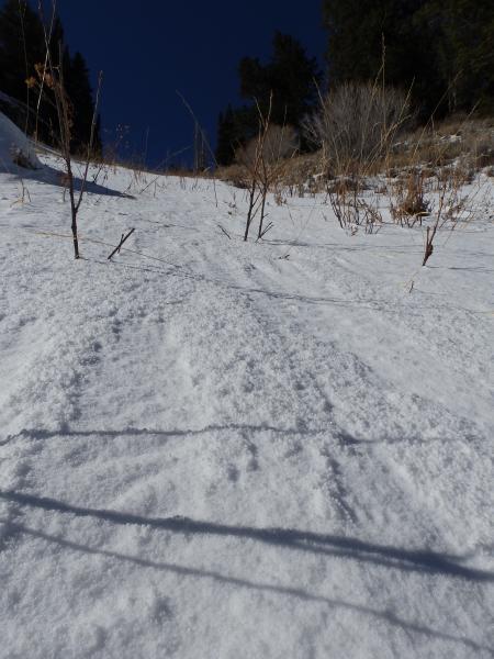
Photo, Graupel runnels.

Note: I did not take any of the standard routes to the upper meadows, if any one is as silly as I was putting it in to follow it, please remember that this route should not be used in periods with any potential for avalanches nor should it become a standard route.

Bushwacking at it's finest, I am not ready to say it is "ski season" yet.

I am close to calling the danger none, but will stick with low in this area.

Danger rating is for the area I traveled today only.

The consistent 3" of dense cover gives the impression that cover is much better than it actually is.

Today's Observed Danger Rating
Low
Tomorrows Estimated Danger Rating
Low