Sign Up for the Utah Snow and Avalanche Workshop (USAW) on December 7th!

Observation: Lake Peak

Observation Date
11/11/2015
Observer Name
toddeo
Region
Southwest » Tushers » Beaver River » Lake Peak
Location Name or Route
Tushers- Mt. Holly, Lake Peak
Weather
Sky
Clear
Wind Direction
North
Wind Speed
Light
Weather Comments
Clear and cold in the morning, plumes on he high peaks this morning, wind died down midday, able to lounge on top of mt holly at 11,900'.
Snow Characteristics
New Snow Depth
12"
New Snow Density
Medium
Snow Surface Conditions
Powder
Wind Crust
Damp
Snow Characteristics Comments

Approx. 12' new above 10,000' in sheltered areas. Apparent snow totals in the alpine were less due to wind. Medium density. Wind crusts/slabs in the alpine. Wind slabs both hard and soft. snow sitting on bare ground on south aspects and facets/crusts on north aspects.

Some wind sheltered south aspects below 10,500 were slightly damp, not likely enough to form much of a crust.

Red Flags
Red Flags
Wind Loading
Cracking
Poor Snowpack Structure
Red Flags Comments
Wind loading and drifting in isolated areas. Drifts up to 24" deep. Exposed areas contained both soft and hard wind slabs. some of the wind slabs were supportable above 10,500' on southerly aspects, minor and isolated. Exposed areas scoured clean of snow. Soft cracking propogating up to 15' was common on the sheltered north aspects on Lake Peak. The new snow in this area is sitting on a 2-4" thick layer of fist hardness 1-2 mm loose, dry facets. The basel layer in this area consists of a 1" thick, knife hard crust. Snow on south aspects is sitting on bare ground, good structure, execpt for the snow depth!
Avalanche Problem #1
Problem
New Snow
Trend
Same
Problem #1 Comments

I would call the issue on north aspects a storm slab sitting on weak facets, this could likely become a persistent deep slab problem with time and additional snow fall. It was not possible to isolate columns today, all broke prior to isolation on a q2 shear/break at the top of the underlaying facets.

At this time this is an isolated/moderate hazard due to the thin snow pack, in general, overall there is not really enough snow to "ski". However it may be easy to trigger an avalanche if skiing in deeper, wind loaded areas, if you can find one.

This hazard may persist for a long time.

Wind slabs in isolated areas of high elevation south areas are also possible, I backed one shot because of this.

Avalanche Problem #2
Problem
Normal Caution
Trend
Same
Problem #2 Comments

Normal caution for this time of year, the snow pack is really thin, the primary danger in this area is rocks and wood.

Snow Profile
Aspect
Northwest
Elevation
10,500'
Slope Angle
30°
Comments

snow profile described above in red flags.
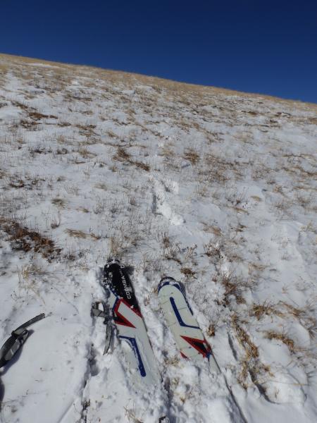
End of the line in the alpine at 11, 700', all new new snow blown away. Walking from here to the summit of Mt. Holly.
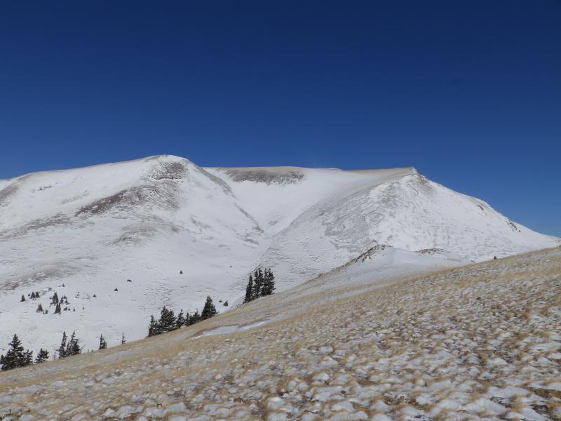
Current snow cover in the alpine, not ready for prime time.

Moderate danger is isolated but worth noting, low in most areas, if someone triggers a pocket, ride will be nasty and require many band-aids.....

Could easily be considerable on north aspects if there was more snow, all the signs are present.

Today's Observed Danger Rating
Moderate
Tomorrows Estimated Danger Rating
Moderate