Observation Date
4/15/2015
Observer Name
Tyler Falk
Region
Salt Lake » Big Cottonwood Canyon » Silver/Days
Location Name or Route
Upper Silver & Days
Weather
Sky
Obscured
Precipitation
Moderate Snowfall
Wind Direction
Northwest
Wind Speed
Light
Weather Comments
Wow what a storm! Wind, Dust, Snow, 30 degree tempature drop in a few hours yestarday. Moderate to high PI rates in the upper cottonwoods this morning. Less wind and wind transport this morning than expected on 10k ridgelines. Felt like winter again.
Snow Characteristics
New Snow Depth
18"
New Snow Density
Medium
Snow Surface Conditions
Powder
Snow Characteristics Comments
The storm snow was more evenly distributed than expected for the wind we received. We found around 18" in most locations in the upper Silver,Days, Alta circuit. Medium to light density with less graupel and wet snow than expected aswell in the new snow.
Red Flags
Red Flags
Heavy Snowfall
Wind Loading
Cracking
Collapsing
Red Flags Comments
Defnitily a few red flags out out there today. I dont know what the exact snow water equilivant was from the storm but assume we picked up a fair bit of weight mabey 2.0" ? Although there are not really alot of weak layers to overload I assume that there are alot of smooth hard sliding surfaces out there for these storm slabs to run on. Seamed like off aspects west and east might be avalancheing easier do to the hard crusts under the storm snow. (Not really any old snow left on south except for the very high elevations so mabey a risk there aswell.)
Avalanche Problem #1
Problem
Wind Drifted Snow
Trend
Decreasing Danger
Problem #1 Comments
With the strong winds overnight I figured wind slabs would be my number one concern. Winds from the W/NW overnight loading the East half of the compass.
Avalanche Problem #2
Problem
New Snow
Trend
Decreasing Danger
Problem #2 Comments
With almost two feet of new snow storm slabs would definitely be packing a punch.
Comments
Seamed like the storm snow bonded well to the more north aspects. Still a height of snow, between 190-220cm in Upper Days on a NW aspect at 9800. Storm snow around 46 cm there. ECT's fairly low energy, Q3 sheers just below the storm snow. Seamed like the snow was fairly well behaved but would definitely give it more time for the wind and storm slabs to calm down before jumping on anything big.
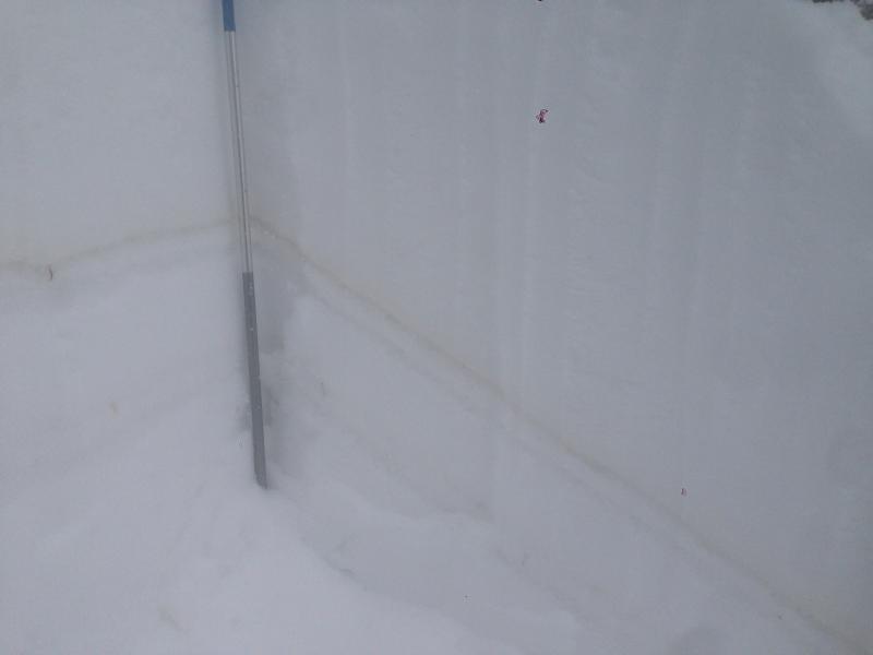
Pic 1. Dust Event clearly visible below storm snow.
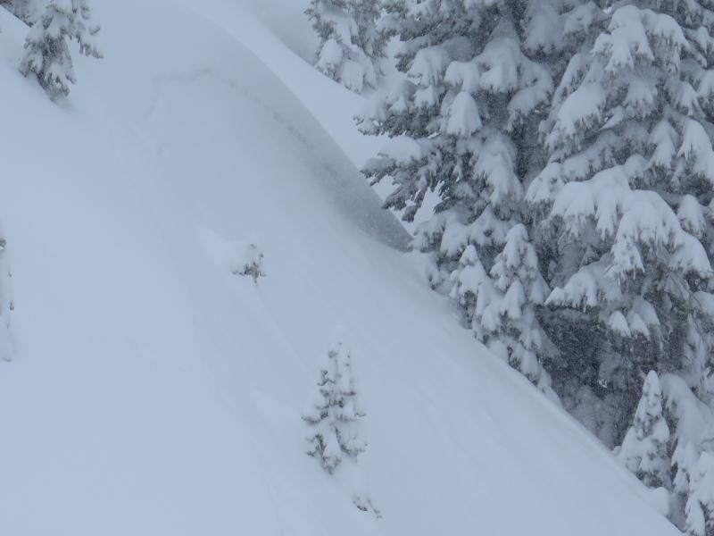
Pic 2. Shallow storm slab in upper silver fork.
Today's Observed Danger Rating
Moderate
Tomorrows Estimated Danger Rating
Moderate