Observation Date
3/25/2015
Observer Name
Kikkert
Region
Salt Lake » Big Cottonwood Canyon » Broads Fork
Location Name or Route
Broads Fork
Weather
Sky
Clear
Wind Direction
Northwest
Wind Speed
Light
Weather Comments
Clear and cool in the AM. Cool enough that upper elevation east facing slopes remained dry until at least 1130 am when we exited. Winds had backed off considerably by mid-morning, with only light winds, even on exposed ridges near 11K.
Snow Characteristics
New Snow Depth
4"
New Snow Density
Medium
Snow Surface Conditions
Powder
Snow Characteristics Comments
Settled new snow depths of course varied considerably with elevation. Only 1" at 8,000', increasing to around 6" above 10,000', but on average around 4". Lots of graupel, which helped keep you off underlying crusts.
Avalanche Problem #1
Problem
Persistent Weak Layer
Problem #1 Comments
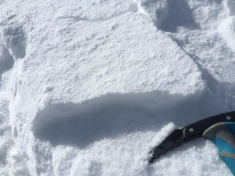
Found lots of very shallow wind slabs above 9,500', but they were mostly only 2-3" deep. We could get them to break out by walking above the skin track, but never got them to crack out any further than right at your skis. Although we avoided some of the more obvious wind pillows, it seemed that most the wind slabs had settled out by mid-morning, even along exposed ridgelines. Also, the thin wind slabs we encountered were soft, composed mainly of wind deposited graupel, which tend to be softer and less sensitive.
Comments
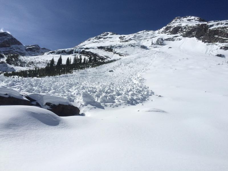
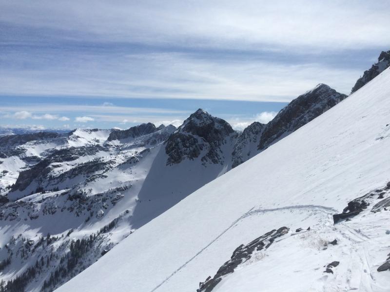
Photos of 1) the thin wind slabs encountered in the alpine, underlain by graupel, 2) the rather impressive glide activity from before the storm, and 3) views were exceptional.
High north should still harbor good skiing for Thursday, other aspects will likely get damp. Moderate tomorrow for wet activity. Given the underlying crusts in many places, seems like wet slides could run farther and perhaps a bit faster than expected.
Today's Observed Danger Rating
Moderate
Tomorrows Estimated Danger Rating
Moderate