In most years we likely wouldn't notice this little of a storm, but quite a treat for this season. Route today was morning tour to Catherine's Pass Area, Dry Fork, and S-facing Wolverine. Departed LCC at noon with storm clouds brewing.
Easiest to summarize findings with bullet points:
- New snow was well bonded to old snow surface.
- Finding the weakest snow to be a density inversion a few cms above the M/F crust.
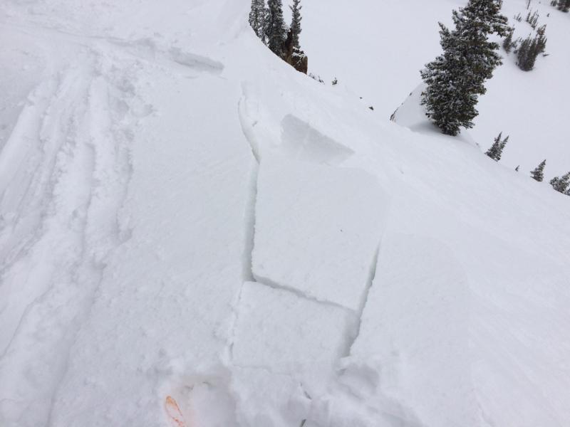
- Lots of fresh, dense wind drifts. But they would only crack locally around my skis.
- Ski cuts and cornice drops onto wind drifted slopes could only get localized cracking with a few class 1 slides. Weak layer was the density inversion just above the M/F crust.
- Saw a UAC tweet later this afternoon mentioning surface hoar that had formed overnight. I wasn't finding any surface hoar today and whatever there may have been was likely eroded from the wind.
Hazard was mostly Low today with Moderate hazard for triggering fresh wind drifts in upper elevation terrain most likely to be found SE and E aspects with some possible cross loading. These drifts were not widespread and I think would be relatively small slides. Concerns going forward for Wednesday include higher than anticipated snow totals and/or increased winds.
Photo showing density inversion just above M/F crust.
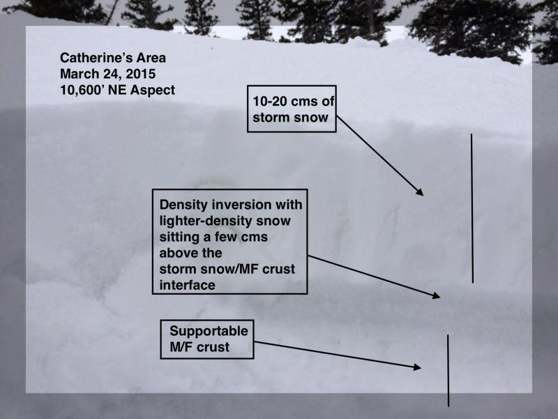
Photo showing cracking in fresh wind drifts along Catherine's ridgeline.