
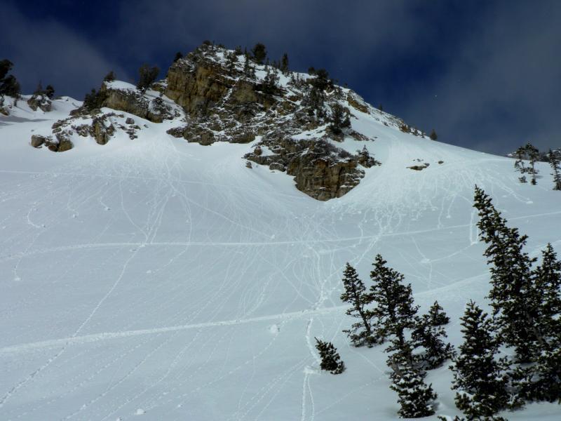
Stayed on the S facing aspects today trying to get some runs in before the forecasted cold front pushed through. S facing aspects held dense dry snow until 10:30- 11:00am, but rapidly became damp with the strong sun and fairly warm temperatures, minor wet activity noted on SE-S. As the cold front rolled in the clouds thickened and the winds increased and got down lower in the drainages, erasing tracks almost as fast as you could make them. The wind was creating some dense slabs on the high ridges and also creating a wind skin down lower in the drainage. Skiing was the same deal as yesterday, low angle skied fairly well but the steeper aspects left you bottom feeding on the old hard snow surface. The damp S facing had crusted up by the time I skied down, around 12:30-1:00pm, and the wind continued to blow. Photos, minor wet activity around 10:30 on SE facing, round two trying to make it up the canyon around noon.
I would think that the main instability today was wind slabs formed by the strong west winds on the high ridges loading E and SE aspects, and also cross loading NE aspects. The new snow seemed to be well bonded in most places, and the underlying old surface had a better freeze on it than it had yesterday. Hazard will depend on wind, new snow amounts and the heating of the sun tomorrow. I would think that wet activity will be the main attraction tomorrow.


