Observation Date
3/5/2015
Observer Name
C Brown
Region
Salt Lake » Big Cottonwood Canyon » Mill D North » West Desolation Ridge
Location Name or Route
West Deso Ridge
Weather
Sky
Clear
Wind Direction
Northwest
Wind Speed
Calm
Weather Comments
Nice clear day, below freezing all day, hardly any wind.
Snow Characteristics
New Snow Density
Low
Snow Surface Conditions
Powder
Damp
Snow Characteristics Comments
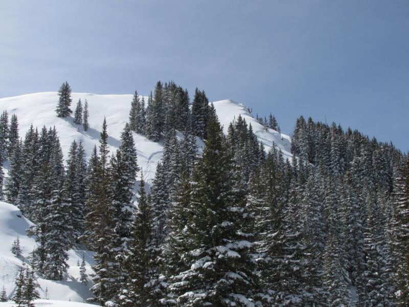
Seeing surface hoar in most areas, decomposing slowly in the sun. Still Fairly light dry powder remaining on NW-NE sheltered areas off West Deso and Deso ridge. Getting wet quickly in southern aspects around 13:00.
Red Flags
Red Flags
Recent Avalanches
Rapid Warming
Poor Snowpack Structure
Red Flags Comments
Surrounded by recent avalnches on NW-NE aspects below West Deso ridge, upper slope and mid slope. 16-18" storm slab is sitting above 8" of NSF from before the storm cycle. Seeing avalnches from yesterday running on the NSF layer. Some of these were from during the storm with about 6" of new snow on the bed surface. South faces were getting wet quickly between 13:00-14:00.
Avalanche Problem #1
Problem
New Snow
Trend
Increasing Danger
Problem #1 Comments
Storm slab is still fairly unconnected but is gaining strength and sitting above what looks to be about 8" of large grain NSF from before the storm. Now full pits, but lots of hand pits seeing more NSF than I thought below the storm slab. Wasn't able to look at all of them closely due to hang fire. I think this could become worse as the storm slab strengthens above the buried NSF.
Avalanche Problem #2
Problem
Wet Snow
Trend
Same
Problem #2 Comments
The new snow will continue to get warmed by the stronger March sun and shed on the afternoon.
Comments
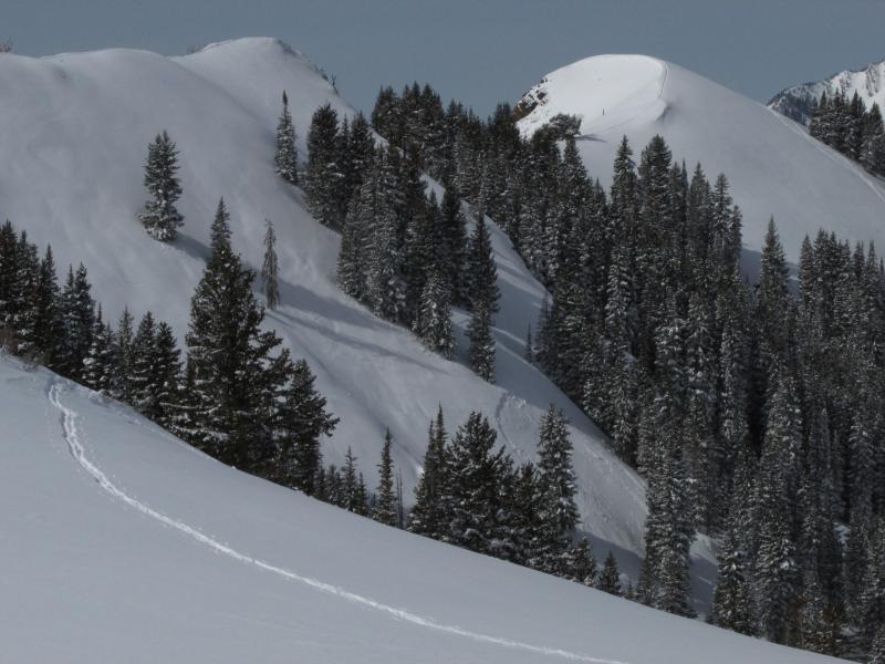
NE aspect of roll off West Deso mid slope below the trees. Appears to be from 3/4/15.
Two crowns, center left (3/4/15) and center right (3/3/15). Both mid slope off West Deso.
This was right off the eastern high point of West Deso Ridge. NW aspect. Appears to have gone during the storm late on 3/3/15, and started on a density change in the storm snow and stepped down to the buried NSF. Start was about 8", stepped down to a total of 16".
Today's Observed Danger Rating
Considerable
Tomorrows Estimated Danger Rating
Considerable