Observation Date
3/3/2015
Observer Name
jg
Region
Uintas » Upper Weber Canyon
Location Name or Route
Upper Weber Canyon
Weather
Sky
Overcast
Precipitation
Light Snowfall
Wind Speed
Light
Weather Comments
Overcast skies, light snowfall and light SW winds early in the day. After noon or so, winds shifted to the NW, skies started to break and snow subsided. Cool winter-like temps with 10K temps in the low teens and upper single digits.
Snow Characteristics
New Snow Depth
7"
New Snow Density
Medium
Snow Surface Conditions
Powder
Snow Characteristics Comments

About 7"-10" new storm snow, fairly evenly dispersed between all elevations traveled. Medium to light density snow fell on very light density snow from the weekend creating a density inversion.

Red Flags
Red Flags
Cracking
Collapsing
Poor Snowpack Structure
Red Flags Comments
Minor cracking and collapsing.
Avalanche Problem #1
Problem
New Snow
Trend
Same
Avalanche Problem #2
Problem
New Snow
Trend
Same
Problem #2 Comments

Step down potential based on snowpack structure and pit tests.

Snow Profile
Aspect
Northwest
Elevation
9,900'
Slope Angle
32°
Comments

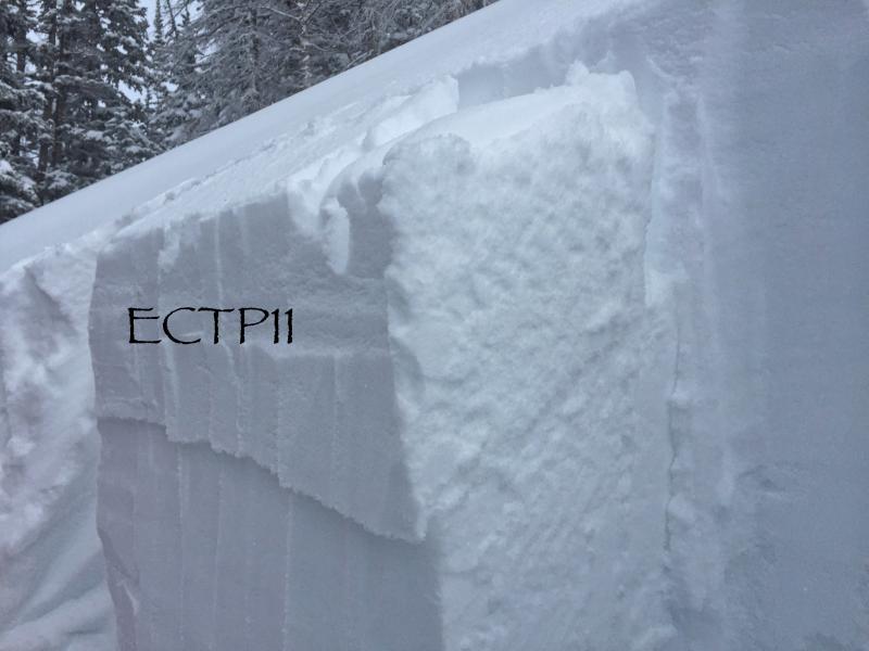
Pit tests reflected easy to easy medium effort to fail with Q2 quality shears.

Traveled from 7400-10,500, north half of the compass, slope angles to 32°. Kept to more gentle terrain and stayed out of the upper elevation wind effected terrain. Wasn't able to see much due to limited visibility.

A little more energy in the upper part of the snow pack today with pit test mostly failing on the interface between this past weekends storm and the old snow surface. If triggered, in the right type of terrain, slides could break to deeper weak layers in the pack. Steep wind loaded terrain would be the kind of terrain to avoid tomorrow.

Moderate to considerable danger tomorrow.

Today's Observed Danger Rating
Moderate
Tomorrows Estimated Danger Rating
Moderate