Observation Date
3/3/2015
Observer Name
Toddeo
Region
Salt Lake » Park City Ridgeline
Location Name or Route
USA Bowl/PC Ridge
Weather
Sky
Obscured
Precipitation
Moderate Snowfall
Wind Direction
Southwest
Wind Speed
Strong
Weather Comments
Blustery Day. A few of sunny breaks that did not last long. Heavy snow (S5) during frontal passage. About 2-3" new during the day after the front passed at about 9.30 am. This may have been the 1st day ever that I walked uphill with goggles on almost all day!
Snow Characteristics
New Snow Depth
7"
New Snow Density
Low
Snow Surface Conditions
Powder
Dense Loose
Snow Characteristics Comments

7" from todays event. A total of 16-18" sitting on the underlaying crust. 2-3" on top of the car at Solitude at the end of the day.

Columns were not easy to isolate this morning but became more stable as the day progressed. The bond to the underlaying crust appears moderate to strong, it took a hard push and broke rather than sheared. Of note in wind exposed areas: A poorly defined break on a density inversion 6-8" below the surface, was noted in many quick columns (no propagation in quick ECTs). The break was not clean but separated with a fairly easy push. This is likely wind related. Open areas in USA Bowl were dense, slightly inverted and wind affected with some minor soft cracking.

Areas along the PC ridge were drifted up to 3" deep in places, soft cracking only.

Red Flags
Red Flags
Heavy Snowfall
Wind Loading
Red Flags Comments
Heavy snowfall during the day was a temporary red flag. The primary red flag today was wind loading onto north aspects along the PC ridge (see photo below). Loading occurred all day. Ski tracks from previous days were visible mid slope in Radar Love Bowl. Tracks were obscured in the upper reaches of the bowl. I walked the ridge during two periods of good visibility without any cracking or settling. Newly formed cornices were sensitive, small cornices drops did not result in any cracking or signs of instability.
Avalanche Problem #1
Problem
Persistent Weak Layer
Trend
Same
Problem #1 Comments

On north and northeast facing aspects in this area, some cross loading.

Although I did not see any major signs of instability, I treated the hazard as considerable. I suspect in only the upper, loaded portions of the PC ridge.

Avalanche Problem #2
Problem
Wet Snow
Trend
Increasing Danger
Problem #2 Comments

If the sun comes out, it is that time of year.

Comments

Photo of loading in Radar Love Bowl.

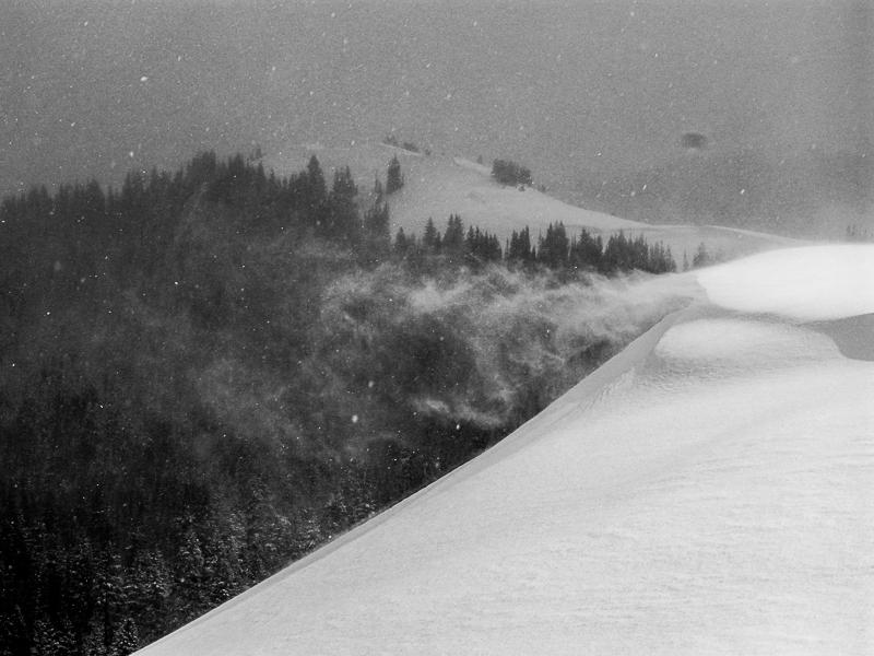
I would call the hazard as considerable in wind loaded areas, moderate elsewhere.

Today's Observed Danger Rating
Considerable
Tomorrows Estimated Danger Rating
Considerable