Observation Date
3/1/2015
Observer Name
Bruce Tremper
Region
Salt Lake » Little Cottonwood Canyon » Red Pine
Location Name or Route
Red Pine to upper cirque
Weather
Sky
Overcast
Precipitation
Light Snowfall
Wind Direction
Southwest
Wind Speed
Light
Weather Comments
Low level moisture with clouds lazily drifiting up and down the canyons and peaks with occasional light snow squalls.
Snow Characteristics
New Snow Depth
1"
New Snow Density
Low
Snow Surface Conditions
Powder
Snow Characteristics Comments

With several periods of snow these past 3 days, there is about 10 inches of low density new snow on a supportable crust. About an inch fell today in scattered snow squalls. Even in the upper bowl just below the Pfiefforhorn ridge, I could not find any evidence of wind drifting, which surprised me. Turning conditions were very good, as you might imagine.

Red Flags
Red Flags Comments
Suprisingly no red flags even in upper elevation, wind exposed terrain just below 11,000'. All the new snow is quite well behaved with a few sluffs coming off the steep cliffs. There was probably some greenhousing on sun exposed slopes during the brief sun periods because of the low clouds, although we did not see any on the north facing slopes where we were. There is some near-surface faceted snow under the new snow and often sandwiched between crusts. The buried faceted snow is mostly above 10,000' on northwest, north and northeast facing slopes. It's definitely there but the new snow weighs almost nothing so it's not nearly enough weight to overload these layers. With the expected snow on Monday, though, we will have to keep a close eye on the storm to see how much weight it adds. Right now, the weakest snow is the snow on the surface right now, so the storm snow on Monday and Tuesday should slide on the surface snow first but could step down into deeper faceted layers. But it seems like it would take a couple inches of water weight to start overloading the buried faceted layers, now about a foot deep in the snowpack.
Comments

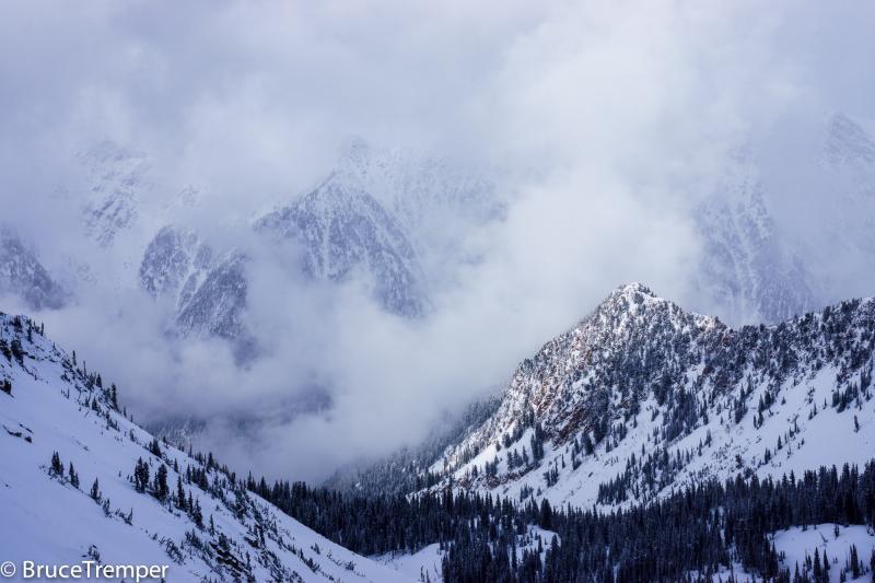
The low level moisture caused scattered clouds up and down the mountain valleys and peaks with occasional snow showers.

Today's Observed Danger Rating
Low
Tomorrows Estimated Danger Rating
Moderate