
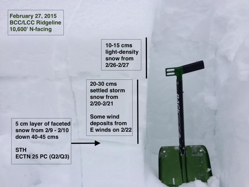
Snow that fell on Feb 9 turned to facets on upper elevation north-facing aspects. I and a few other people noted this last Saturday (Drew, Bruce) and it is worth keeping track of persistent weak layers. Not much going on in the snowpack these days so I thought I'd spend time looking at that weak layer that is now down about 40-45 cms underneath the two recent storms as well as last weekend's Easterly wind event.
Overall I was finding last Saturday that the fine-grained faceted snow did not look especially weak, and at the time we did not have enough of a load on top to even make this weak layer become active. The facets are appearing to gain strength and sinter, and today I was only able to get hard Q2/Q3 shears at this layer. ECTN25.
Overall danger is Low with the only hazard being sluffing in the new snow. The overall snowpack is strong and stable, and upper elevations are set up quite well if for some crazy reason the weather Gods decide to gift us a stormy March.
Photo shows faceted layer from 2/9 storm now down 40-45 cms.
Video describing upper elevation N-facing snowpack.


