Observation: Wilson Chutes

Observation Date
2/23/2015
Observer Name
Kikkert
Region
Salt Lake » Mill Creek Canyon » Wilson Fork » Wilson Chutes
Location Name or Route
Wilson Chutes - Soldier Fork
Weather
Sky
Clear
Wind Direction
Southeast
Wind Speed
Light
Weather Comments
Winds were a bit stronger than extected along the upper Wilson ridgeline, blowing mainly from the SE 15-20 mpg. Most the snow transport had already occured overnight, with the ridge mostly scoured down to the old crust. Winds began to die down around noon.
Snow Characteristics
New Snow Depth
5"
New Snow Density
Medium
Snow Surface Conditions
Powder
Dense Loose
Snow Characteristics Comments

New snow had settled to about 5 inches, not sure how much the Millcreek ridgeline got out of the storm, but based on settlement would guess around 8. Winds not only drifted snow into the lee facing bowl and some of the chutes, but also looked to have blown up the chutes overnight, with a little soft wind rippling in the lower bowl. South facing aspects were either bare (no snow) or the new snow had already melted down to the old crust.

Red Flags
Red Flags
Wind Loading
Red Flags Comments
Obvious drifts from the SE winds on primarily north aspects (didn't travel on W); however, the drifts were relegated to right along the ridgelines (see below).
Avalanche Problem #1
Problem
Persistent Weak Layer
Problem #1 Comments

Very obvious shallow wind slabs on lee (north) slopes and crossloaded a bit on the upper east facing chutes. Very easy to ski cut or even just stomp on them, breaking out only right along the ridgelines. Typically less than 6 inches deep, although one broke out closer to 10 inches deep. Very limited in size and distribution, not much energy, and not entraining much snow as they ran. Once you got a feel for their size, they were not a concern.

Would imagine most will settle out overnight, although a forecasted shift in wind direction tomorrow may bring a few new ones, probably a low end pockety moderate, otherwise low. Never really got a feel for south facing, as there is almost no snow on mid-elevation south facing in mid Big Cottonwood.

Snow Profile
Aspect
Northeast
Elevation
9,400'
Slope Angle
32°
Comments

Not enough new snow for a slab and couldn't get any results in tests. Doesn't look like we will get enough of a load soon enough to activate the NSF/graupel layer that is now buried, nor does it appear to have been overly week to begin with in this area. New snow is already faceting though, with a bit of surface hoar overnight.

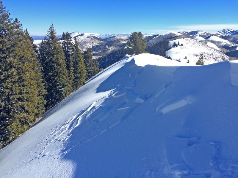
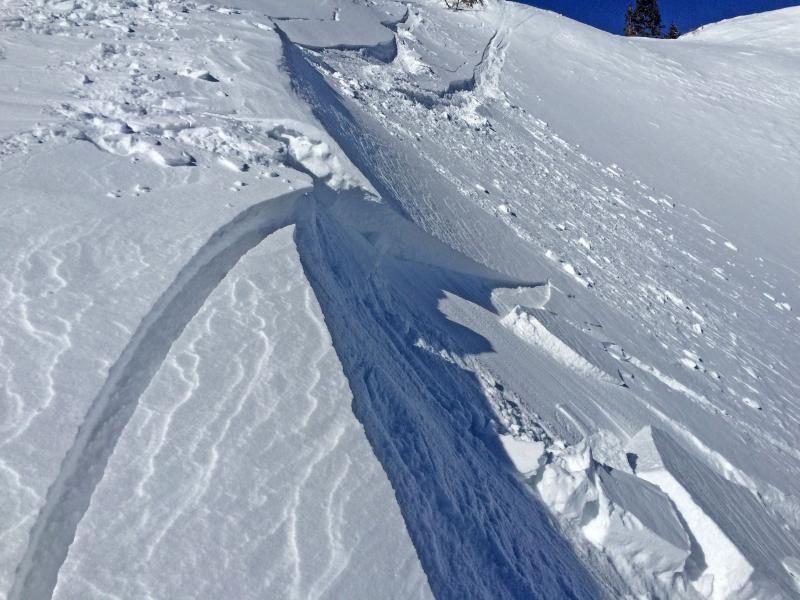
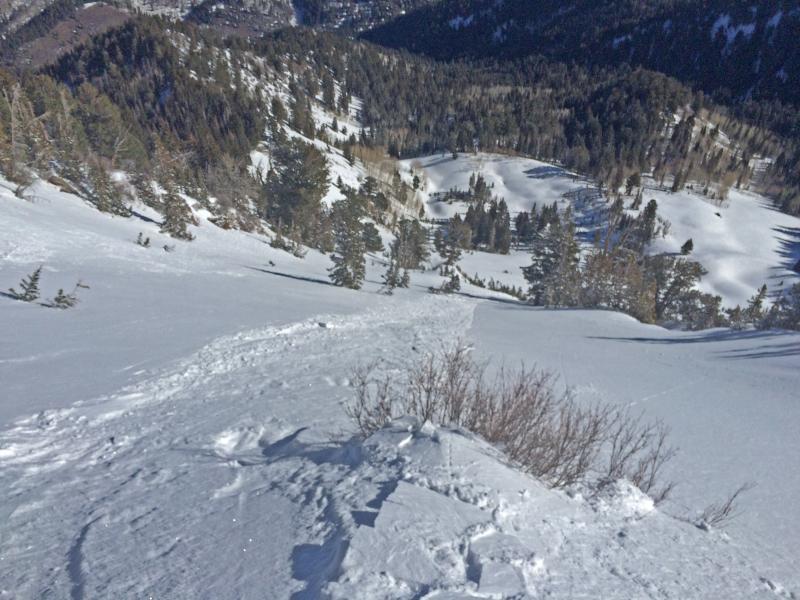
Photos of the small windslabs, and runout of the only one that ran any distance (was slow running)

Today's Observed Danger Rating
Moderate
Tomorrows Estimated Danger Rating
Moderate