Observation Date
1/14/2015
Observer Name
jg
Region
Uintas » Upper Weber Canyon » Smith-Moorehouse
Location Name or Route
Smith and Morehouse Area
Weather
Sky
Clear
Wind Direction
Northeast
Wind Speed
Light
Weather Comments
Cold this morning with blue skies all day. Warm in the sun, cold in the shade. Light winds on the ridgelines from the N/NE.
Snow Characteristics
New Snow Depth
12"
New Snow Density
Low
Snow Surface Conditions
Powder
Wind Crust
Damp
Snow Characteristics Comments

Nice settled powder. Damp snow on south aspects. Dense wind effected snow in the upper elevation open terrain; up to 4" thick and easily sliding on the new snow. Surface hoar growing at all elevations traveled. Surface and near surface faceting observed as well.

Red Flags
Red Flags
Recent Avalanches
Wind Loading
Cracking
Poor Snowpack Structure
Avalanche Problem #1
Problem
New Snow
Trend
Same
Problem #1 Comments

The new snow was sluffing in steeper terrain but was easily managed if you were paying attention.

Snow Profile
Aspect
North
Elevation
10,200'
Slope Angle
30°
Comments

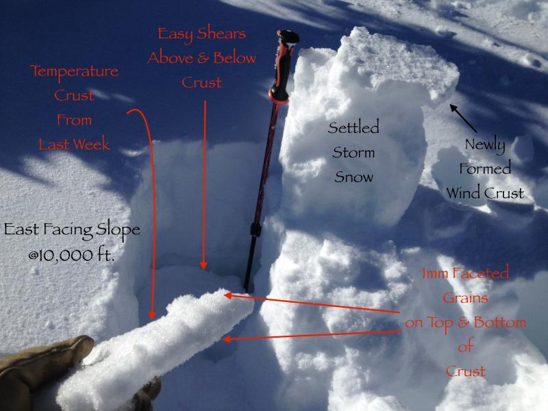
Very easy shears of the new storm snow on the melt/freeze crust from last week on this east facing slope at 10K.

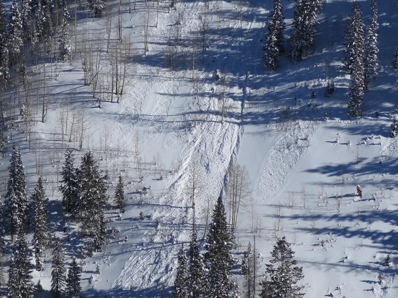
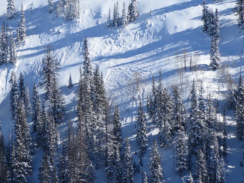
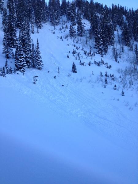
New storm snow, loose snow avalanches on east, west and north facing slopes in the area traveled.

Traveled from 7400 ft.-10,400 ft., all aspects, slope angles to 40°. Observed instability in the storm snow only. Sluffs were running on 35°+ slopes but were fairly easily manageable. That being said, if you were caught off guard you could easily get knocked down in the wrong spot.

Still a lot a spacial variability to consider, especially in rocky terrain with a shallower snowpack. Snow pit tests reflected the new storm snow/temperature crust interface as being weak as well as the deeper early snow/Christmas storm interface. No result on ECT. Temp profiles reflect a healing pattern from last week's temperature crust downward in the pack but the upper portion of the pack is showing a temperature gradient.

Sun/heat influences could effect stability in the near future.

Today's Observed Danger Rating
Moderate
Tomorrows Estimated Danger Rating
Moderate