Observation: Hogum

Observation Date
1/2/2015
Observer Name
Dylan Freed
Region
Salt Lake » Little Cottonwood Canyon » Hogum
Location Name or Route
Maybird/Hogum
Weather
Sky
Clear
Wind Direction
Northwest
Wind Speed
Calm
Snow Characteristics
Snow Surface Conditions
Powder
Faceted Loose
Wind Crust
Snow Characteristics Comments
Variety of snow surface conditions ranging from undisturbed F hard powder/NSF's with 2-5mm surface hoar in protected shady terrain to soft wind-pressed (feathers and leopard skin) and thin wind slabs(P hard) on upper elevation terrain. No surface hoar observed in any upper elevation starting zones.
Red Flags
Red Flags
Wind Loading
Poor Snowpack Structure
Red Flags Comments
Not the typical POOR structure; continually improving mid-pack persistence and basal facets on upper elevation above 9k' E-NW aspects. Most areas where we want to ski contain Moderate structure as observed in pits. Un-supported consequential terrain features and areas lee to any significant previous wind load continue to give me caution.
Avalanche Problem #1
Problem
Persistent Weak Layer
Trend
Same
Problem #1 Comments
With winds from any and all directions previously loading slopes these seem to be un-reactive, but the likelihood of triggering a stubborn one in unfriendly terrain keeps me cautious and wary of suspect snow surface clues.
Avalanche Problem #2
Problem
New Snow
Trend
Same
Problem #2 Comments
With our increased snow depths and moderate temperatures I've seen gains(in Strength, improvements in Structure, and decreased Propagation Propensity) in both the mid-pack persistence of NSF's formed above and below the ~Dec11-12 temp crust apparent in most pits and the basal facets at the bottom of our snowpack on slopes facing E-NW above 9k'. This problem seems dormant for now, but likelihood of triggering comes down to Structure on the slopes we choose to ski and how the Terrain effects the slab continuity.
Snow Profile
Aspect
Northeast
Elevation
10,100'
Slope Angle
36°
Comments
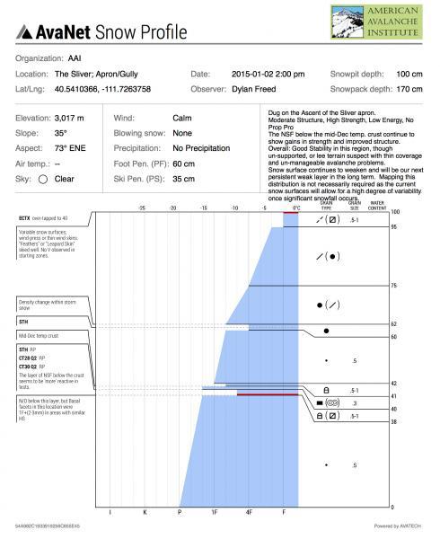
Profile from apron approaching The Sliver
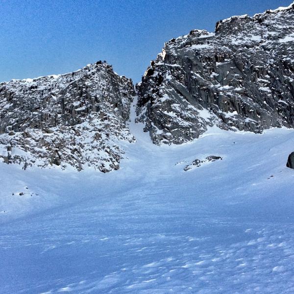
Photo from pit location looking up The Sliver
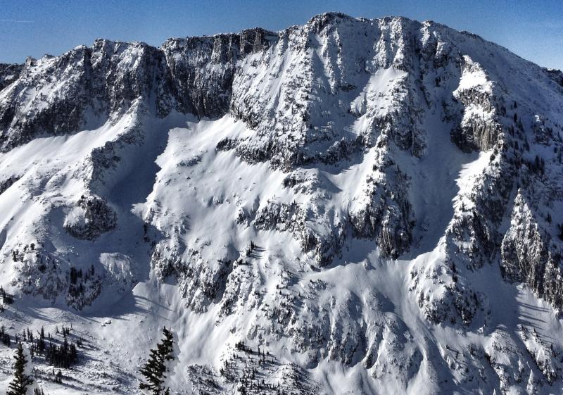
Coverage on Lightning Ridge; Hogum Fork
Today's Observed Danger Rating
Moderate
Tomorrows Estimated Danger Rating
Moderate
Coordinates