Observation Date
12/31/2014
Observer Name
Darce Trotter/Steve Cote
Region
Skyline » Huntington Canyon » Electric Lake
Location Name or Route
Middle East Electric Lake Bowl
Weather
Sky
Clear
Wind Direction
Northeast
Wind Speed
Moderate
Weather Comments
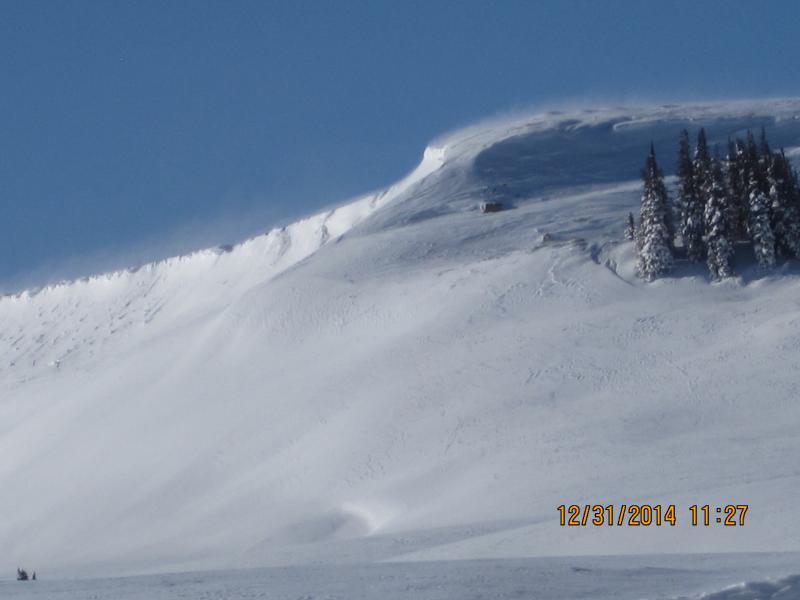
bitter cold today, winds continue to nuke out of NE, eroding snow from typical starting zone at summit ridge tops and loading unusual S through W areas. Channeling of wind by terrain with crossloading and odd distribution for Wasatch Plateau will require carefull assessment of snow depth and loading
Snow Characteristics
New Snow Depth
2"
Snow Surface Conditions
Powder
Wind Crust
Snow Characteristics Comments
Ridgetops loading upslope from usual E facing starting zones, eroded to rocks in many places along Wedding Ring Ridge, thin rock areas exposed now and will facet with cold temps, when usual storm patterns return, setup for persistant slabs could be re-establised, time will tell.
In sheltered areas snowpack depth continues to increase with overall strengthening, good news for a lot of NW through NE slopes off ridges,
Red Flags
Red Flags
Wind Loading
Poor Snowpack Structure
Red Flags Comments
Loading patterns are backwards and warrant careful assessment of S through W slopes, crossloaded gullies, etc.
thin eroded rocky areas are going to need watching, especially if we go high and dry on weather for long period
Avalanche Problem #1
Problem
Persistent Weak Layer
Trend
Increasing Danger
Problem #1 Comments
S through W slopes are being loaded, backwards from typical patterns, hard slab conditions exist.
Avalanche Problem #2
Problem
New Snow
Trend
Increasing Danger
Problem #2 Comments
we could be getting a reset on weak faceted snow in thin rocky areas that had been buried and picking up stability due to strong erosion from E winds. When usual pattern resumes, and it will, first storm may build persistent slabs with weak snow beneath. Thought we were out of the woods of this for the current season, but . . .
Snow Profile
Aspect
Northwest
Elevation
9,400'
Slope Angle
20°
Comments
overall pack is increasing in depth and strength in sheltered areas but hazard is considerable in recent wind loaded, cross loaded sloped SW through W facing
Winds eroding usual E facing starting zones at summit ridges
A look at snowpack in sheltered area
Video
ECT shows strong pack in sheltered areas
Today's Observed Danger Rating
Considerable
Tomorrows Estimated Danger Rating
Considerable
Coordinates


