Join us at our 2nd Annual Blizzard Ball

Observation: Electric Lake

Observation Date
12/24/2014
Observer Name
Darce Trotter / Steve Cote
Region
Skyline » Huntington Canyon » Electric Lake
Location Name or Route
Skyline, Electric Lake
Weather
Sky
Clear
Wind Direction
West
Wind Speed
Light
Weather Comments
great day for scoping out recent activity, widespread typical wind damage has stripped W facing ridges to bushes, again, but winds were light today, picked up late in the day from WSW a head of next system.
Snow Characteristics
New Snow Depth
17"
Snow Surface Conditions
Powder
Snow Characteristics Comments

Storm totals have settled to 45 cm (17") with total of 85 cm (34") at Miller Flat snowstake.. Snotel had reported 3"-4" of water settlement cones around trees and bushes were only a few inches tall, bridge over facets is strong and continues to strengthen, very happy with changes to pack, we are headed in the right direction and if next storm materializes, depth will decrease change of gradients setting up, hopefully deep slab instability will start to fade. Certainly has started winter on the Wasatch Plateau, supportable pack allows travel just about everywhere, lots of snowmobile slope testing evident with no new activity, still leery of extreme terrain, especially shallow rocky areas, some stripped by the wind.

We did not have any collaspes, cracking, etc, today, and all the activity we saw was likely during the storm. Seems Fairview Canyon and points north got the brunt of the storm, with lessening amounts the further south you go, ie Ephraim Canyon did not seem to have as much new snow and water, so southern reaches could still be in persistent slab cycle

Red Flags
Red Flags
Recent Avalanches
Heavy Snowfall
Wind Loading
Red Flags Comments
feel extreme hazard of current pack has passed, snowpack is stronger than we saw in area until much later last year, with the exception of pockety hazards, overall moderate hazard
Avalanche Problem #1
Problem
New Snow
Trend
Decreasing Danger
Problem #1 Comments

still cannot erase concerns considering the huge area involved in Wasatch Plateau,

Avalanche Problem #2
Problem
New Snow
Trend
Increasing Danger
Problem #2 Comments

with next storm on horizon, and low density snow on surface and filled in on paths that already run, bonding of new and old snow will be the most active hazard, if 3"-4" of water did not push some paths over the edge during last storm, this

Snow Profile
Aspect
Northeast
Elevation
9,400'
Slope Angle
29°
Comments

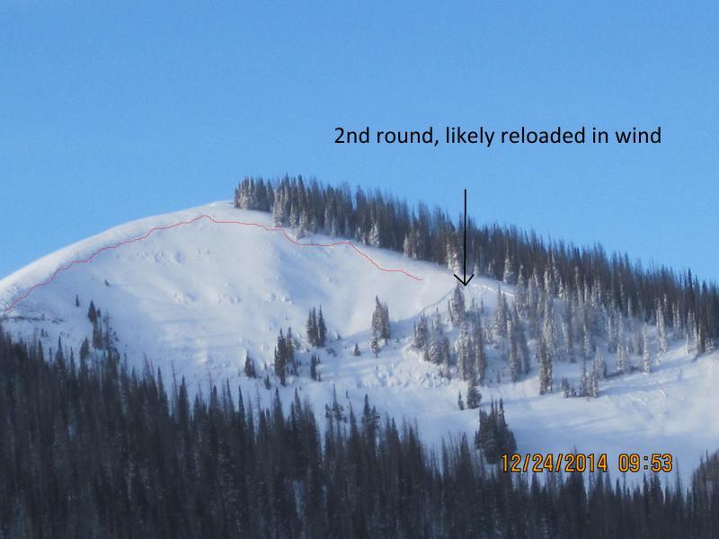
Activity in Phone Shot

Only the second time we have seen this activity in Big Meadow, but slid last year too.
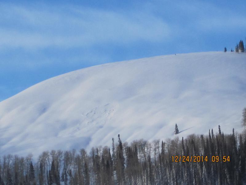
A look at the improved snowpack

Video

ECT nonreactive

Today's Observed Danger Rating
Moderate
Tomorrows Estimated Danger Rating
Considerable
Coordinates