Observation Date
12/23/2014
Observer Name
jg
Region
Uintas » Upper Weber Canyon » Weber Canyon
Location Name or Route
Weber Canyon
Weather
Sky
Clear
Wind Direction
Northeast
Wind Speed
Light
Weather Comments
Bluebird day in the mountains. Cold temps felt more like winter. Teens at 9K and single digits at 10K. Light to moderate winds from the NNE.
Snow Characteristics
New Snow Depth
13"
New Snow Density
Low
Snow Surface Conditions
Powder
Snow Characteristics Comments

12"-18" new storm snow. Marked difference from yesterday, with nice sliding conditions today. Occasionally I could feel the tails of my skis punching through the density inversion in the new snow but pretty fine skiing overall. Mostly supportable on a snow machine and on skis. Some surface hoar noted above 9800 ft. Rain crust below new snow below 8000-8200 ft.

Red Flags
Red Flags
Recent Avalanches
Wind Loading
Cracking
Collapsing
Poor Snowpack Structure
Red Flags Comments
Lots of cracking in the new snow today. I had a dozen or so loud whoompfs that made me stop in my tracks.
Avalanche Problem #1
Problem
New Snow
Trend
Same
Avalanche Problem #2
Problem
Persistent Weak Layer
Trend
Same
Snow Profile
Aspect
Northwest
Elevation
10,100'
Slope Angle
26°
Comments

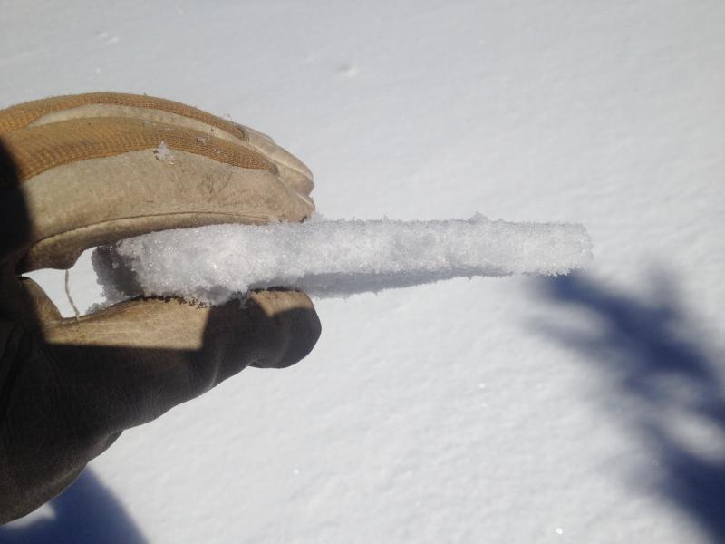
Rain crust formed at the beginning of the storm found at elevations to 8200 ft.

Results of pit tests.

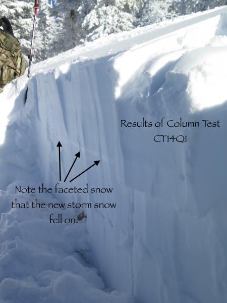
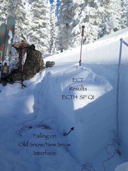
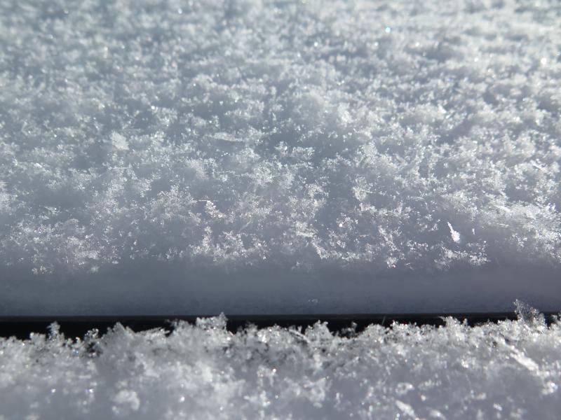
Stacked stellars with some surface hoar growing and the basal facets from my snow pit. Basal facets rounding and necking.

Traveled from 7400 - 10,200 ft., north half of the compass. What a difference a day makes! Pit tests results reflected moderate effort to fail with a propensity to propagate a fracture. I would continue to call the danger considerable to high in the areas I traveled. Another cold night tonight will help develop more surface hoar. I did notice snow plumes off of some of the high ridges moving a fair amount of snow so there was some wind slab building going on today.

Today's Observed Danger Rating
High
Tomorrows Estimated Danger Rating
High