Observation: Park City Ridgeline

Observation Date
12/23/2014
Observer Name
Greg Gagne
Region
Salt Lake » Park City Ridgeline
Location Name or Route
Park City Ridgeline
Weather
Sky
Clear
Wind Direction
North
Wind Speed
Light
Weather Comments
Relatively cool temps (-10C @ 0930 and likely never rose above -8C) and only a hint of northerly winds. Stunningly beautiful day.
Snow Characteristics
New Snow Depth
5"
New Snow Density
Medium
Snow Surface Conditions
Powder
Wind Crust
Snow Characteristics Comments

The weekend storm exited and finished off with 10-15 cms (4"-6") of dense graupel and rimed stellars. Riming was noted on aspen trees with westerly aspects, although I was unable to find any rime layer in the snowpack (although I think others may have noticed it.)

Really difficult to gauge storm snow given the strong winds, but was finding snow depths from 60 cms (2') to 1.2 meters at higher elevations.

The dense snow and wind has created a stout storm snow slab that ranges from 4F to even Pencil-hard wind drifts.

Red Flags
Red Flags
Recent Avalanches
Wind Loading
Collapsing
Poor Snowpack Structure
Red Flags Comments
Numerous very loud collapses (I call them "Entwistle" collapses - perhaps Craig Gordon will be the only one that knows what I am referring to) along PC ridgeline.
Avalanche Problem #1
Problem
New Snow
Problem #1 Comments

Loud collapses are a good reminder of poor pre-existing snowpack structure with a 5-15 cm layer of preserved near-surface facets that are now buried 15-75 cms (6"-30") down from the snow surface. (With greater depths found on wind-loaded Easterly aspects.) From what I saw of a few slides on Sunday 12/21 as well as today, it appears this layer of NSF is the weak layer. We sound like a broken record, but they are called "persistent" weak layers for a reason, and although it is likely that triggering one is increasingly difficult, avalanches breaking down to this weak layer would be very large and dangerous.

I noticed four slides today that apparently ran on this layer:

- slide on North aspect in West Willow (reported)

- slide on SouthEast aspect up ridge of West Willow slide

- slide on SouthEast aspect in West Monitor

- slide on Northeast/East aspect in South Monitor (reported)

All slides I have been noticing seem to be mostly pockets, and only the large slide in West Willow was connected across terrain features.

Comments

Route today was cruising the PC ridgeline between the Willows and USA Bowl.

The bluebird created perfect visibility for viewing avalanche activity over this past storm, and I guess what surprised me most was what I didn't see - that is, the lack of widespread natural activity from this storm. It is very likely that much of the activity occurred earlier in the storm and crowns filled in from the heavy snow and strong winds.

Brett described the forecast perfectly ("Things will become more stubborn today and obvious signs of avalanche instability may not be present") and apart from a handful of slides and several loud, thundering collapses, there were few obvious signs of the present avalanche hazard. The storm snow provides for excellent travel, and the dense snow that fell on Monday makes for excellent riding, even on low-angled slopes. I dug numerous quick pits and there was a fair amount of spatial variability (CTN to even CTV down in basal facets on one slope), so difficult to hang your hat on results. But overall the storm slab appears to have stiffened up quite a bit and it is bridging the layer of near-surface facets.

Overall I am thinking that in the Wasatch, we just aren't used to warm windy storms such as this and that perhaps things are healing faster than we are accustomed to. But even though my PacNW friends tell me that 2 days after a storm in the Cascades you can ski anything, the 3-4" of SWE was a rapid and substantial load for our weak Wasatch snowpack.

Came away with the feeling that increasingly unlikely you can trigger a slide, but our poor snowpack structure with a persistent weak layer still needs time. Fortunately there is plenty of safe and excellent travel and ski conditions.

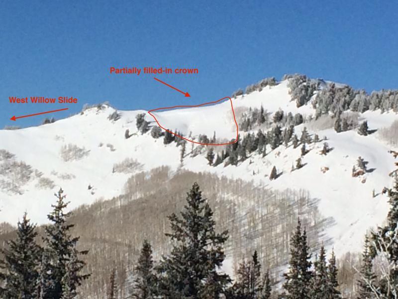
First photo is of what appears to me (from quite a distance) of a partially filled in crown on a SE aspect just below 10K. This is just up the ridge of the large slide along West Willow ridgeline.

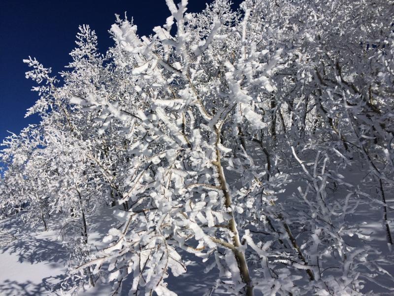
Second photo is of riming found on windward aspects on aspen trees.

Hazard rating?? I would have to call it Moderate as I do not think natural avalanches are possible. But this is the real-deal Moderate and not the "Moderate is the new Low".

Today's Observed Danger Rating
Moderate
Tomorrows Estimated Danger Rating
Moderate