Observation: Silver Fork

Observation Date
12/21/2014
Observer Name
Paradis / Caplis
Region
Salt Lake » Big Cottonwood Canyon » Silver Fork
Location Name or Route
Silver Fork
Weather
Sky
Obscured
Precipitation
Heavy Snowfall
Wind Direction
West
Wind Speed
Strong
Weather Comments
Today felt like skiing in the Cascades - warm, windy and wet. I think I was pretty well soaked even before our first run.
Snow Characteristics
New Snow Depth
8"
New Snow Density
High
Snow Surface Conditions
Powder
Snow Characteristics Comments

The new snow was more dense than the existing snow which made for relatively poor, inverted riding conditions (by Utah standards, anyway).

Strong winds were moving snow so that exposed locations were nearly scoured or supportable while other locations had deep drifts.

Red Flags
Red Flags
Recent Avalanches
Heavy Snowfall
Wind Loading
Cracking
Rapid Warming
Poor Snowpack Structure
Red Flags Comments
Just about all the boxes could be checked today. From other reports and weather stations, it looked like it continued to warm later in the afternoon, after we had left.
Avalanche Problem #1
Problem
Persistent Weak Layer
Trend
Increasing Danger
Problem #1 Comments

Strong winds plus warm dense snow - good snowball making snow - formed numerous wind slabs that easily responded to human weight. The difference between more and less wind loaded slopes could be easily observed on test slopes and by cracking in the new snow.

Avalanche Problem #2
Problem
New Snow
Trend
Increasing Danger
Problem #2 Comments

Near surface facets that formed during the period of dry weather earlier in December have now been buried by snowfall from a few small snow events plus snow from today. In our pit, these were about 40 cms down and above the now strong slab from late November. The current snowpack has nearly all of the structural lemons,

Depth - weak layer <= 1m = Yes

Weak layer thickness < 10cm = Yes

Hardness difference >= 1 step = Yes

Grain type is persistent = Yes

Grain size difference >=1 mm = No

Snow Profile
Aspect
North
Elevation
9,000'
Slope Angle
25°
Comments

This profile is from near the test slope shown below.

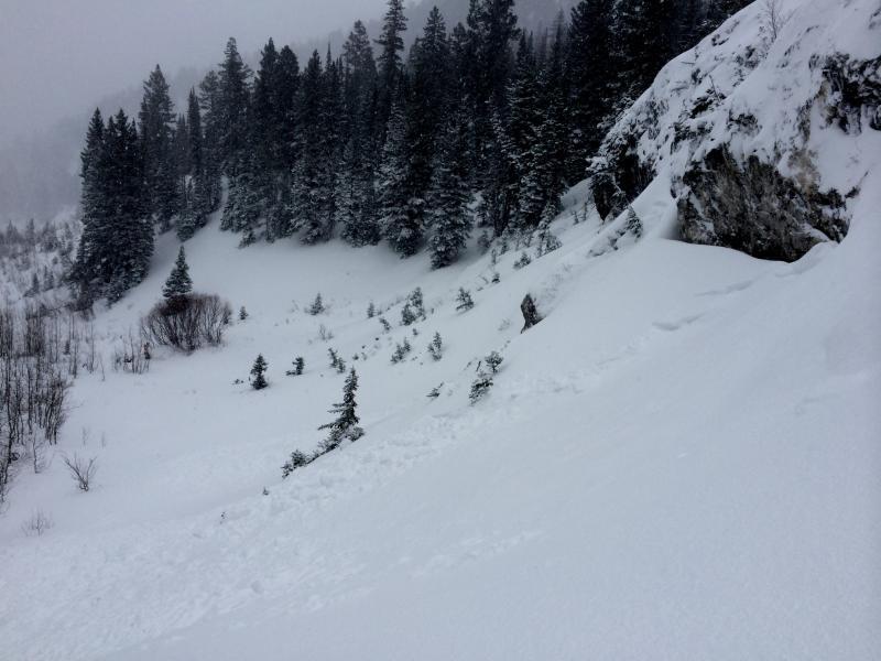
I was able to remotely trigger this small avalanche on a test slope by jumping on an adjacent, lower angle portion of the slope.

Today's Observed Danger Rating
High
Tomorrows Estimated Danger Rating
High