The snow pit above was pretty atypical of the overall terrain. I didn't think this pocket would have been so heavily wind loaded but I was wrong. About twice as much snow as in zones out of the wind but the story is still the same, weak faceted snow below the storm snow is creating a weak interface.
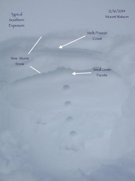
Southern aspects saw some solar effect on Sunday and Monday an there was a thin melt/freeze crust in the new snow. The new snow was not bonding well to the old faceted snow surface. Observed several new snow slides on steep slopes with a southerly aspect.
More nordic skiers on the Mirror Lake Highway today than snow machines. Terrain starting to fill in in the upper elevations of the Uintas but still a pretty thin snowpack with lots of rocks showing or just barely covered. Traveling is supportable, even with the thin pack, due to the warm temps in November consolidating the pack. Weak snow that developed during the dry spell continues to be the weak layer to keep an eye out for. Wind will be a big factor in the coming days since there's a lot of light density snow available for transport. Moderate danger in the wind zone, low to moderate out of the wind zone depending on slope angle.


