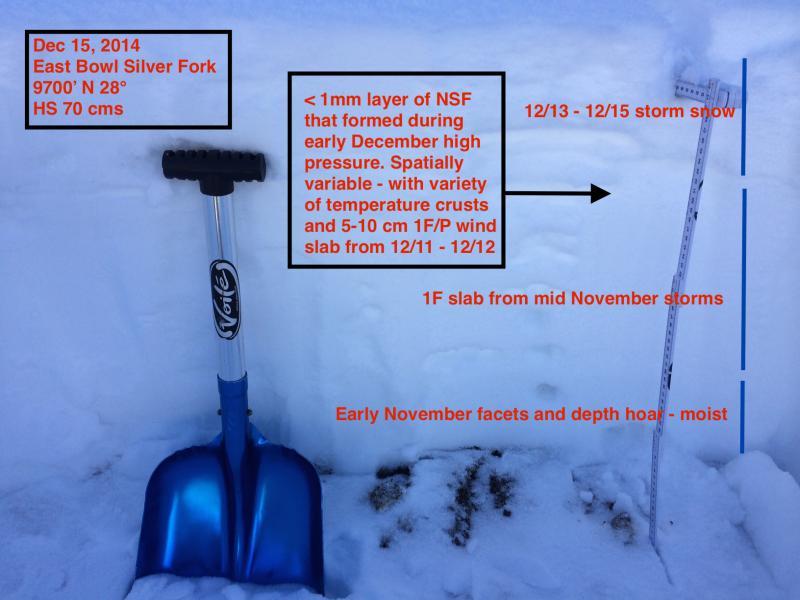
First time in Silver Fork this season. The East Bowl is generally quite rocky and often harbors weak snow in the early season. Today did not disappoint. Quite a bit of spatial variability with some areas containing 90 cms snow depths with stout 1F mid-pack slab, while other areas are much thinner consisting of very loose facets and depth hoar.
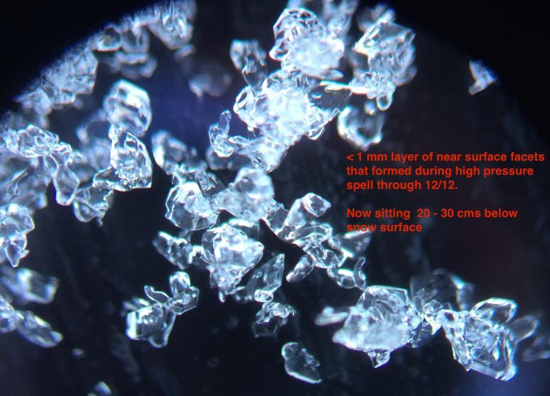
Have been paying attention to the layer of near-surface facets that formed during the early December period of high pressure. Over the past 3 days I have been finding this layer to be preserved and northerly aspects in upper LCC and it is now buried 20-30 cms down from the snow surface. Quite a bit of variability:
- in some areas the weekend storm snow is directly interfacing with this layer of NSF;
- am finding some thin (~5 cms) 1F/P hard wind slabs from last Thursday (12/11) wind event on top of this weak layer;
- also finding some temperature crusts above this layer.
In many locations this layer of NSF is also sitting on top of the 1F mid-pack slab that provides a nice bed surface.
Overall these facets do not look especially weak (see photo) and I was unable to get failures in this layer with any stability tests. (Of course there is only a F-hard slab on top.)
I've been fortunate to get out the last 3 days and my take on the current snowpack is it is stable but this layer of near-surface facets forms a persistent weak layer that we will have to watch when we get new snow and/or wind. Looking at the Dec 15 afternoon Cottonwood Canyon forecast and it appears winds will increase from the S/SW, and there is plenty of light density snow available for transport.
I suspect these will act as a weak layer with any wind loading.
Hopefully others will comment on what they are finding with this faceted layer.
Am calling hazard Moderate with avalanche problem of sluffing in the snow surface.
Photo of snowpack profile in East Bowl of Silver Fork.
Layer of near-surface facets now buried 20-30 cms below snow surface.