Observation: Patsy Marly

Observation Date
11/23/2014
Observer Name
Paradis
Region
Salt Lake » Little Cottonwood Canyon » Grizzly Gulch » Patsy Marly
Location Name or Route
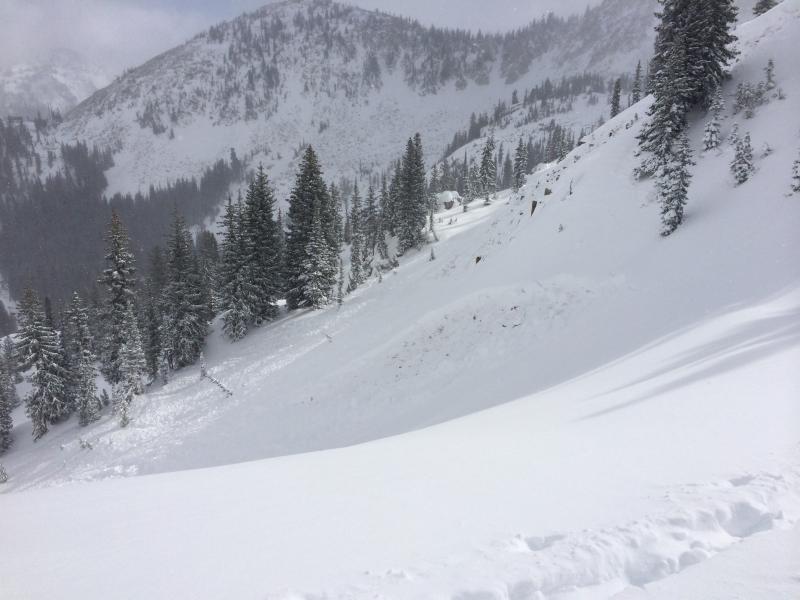
Patsy Marley
Weather
Sky
Broken
Precipitation
Light Snowfall
Wind Direction
West
Wind Speed
Light
Weather Comments
Started snowing more as I was leaving around 1:30pm. It was generally pretty nice while I was out - light snow, wind, and moderate temps. The visibility was pretty decent and allowed for a look at snow cover and recent avalanche activity.
Snow Characteristics
New Snow Depth
2'
New Snow Density
Medium
Snow Surface Conditions
Powder
Snow Characteristics Comments

New snow was in pretty good shape - good density and not wind affected but more is needed to cover rocks.

Red Flags
Red Flags
Recent Avalanches
Heavy Snowfall
Poor Snowpack Structure
Red Flags Comments
I didn't personaly collapse or crack anything but most other red flags were there. Snow structure was poor with about 2 feet of new snow sitting on weak facets near the ground. Noted slide adjacent to Twin Lakes Pass that broke to the ground and took all the new snow with it. Another smaller new snow slide was also visible on the Twin Lakes side of Honeycomb.
Avalanche Problem #1
Problem
New Snow
Trend
Increasing Danger
Problem #1 Comments

Early season facets - I like Greg's term "USAW facets" - plus lots of new snow have created classic early season slab instabilities. The storm slab is about 2 feet deep which a common depth for human triggered avalanches involving facets.

Avalanche Problem #2
Problem
New Snow
Trend
Increasing Danger
Problem #2 Comments

I didn't ski anything steep enough that new snow could be a concern by itself. I'm sure that would be possible but my primary concern related to new snow is that it adds load that can create avalanches involving deeper persistent weak layers.

Snow Profile
Aspect
West
Elevation
10,000'
Slope Angle
25°
Comments

The snow structure here was almost identical to what Greg Gagne reported at Cathrine's Pass. About 20cms of early November facets, mixed snow from mid-month, then lots of storm snow from the past two days.

I also looked at little at south and east faces. South facing near the top of TLP had storm snow, then a melt freeze crust capping some facets.

Hand pits in flat safe east areas near the top of the TLP slide below not surprisingly showed snow snow over facets.

This is the same slide as the photo posted on Twitter earlier today. I did not create a new avalanche observation for this since I'd assume it has already been entered.

Today's Observed Danger Rating
High
Tomorrows Estimated Danger Rating
High
Coordinates