Observation Date
5/4/2014
Observer Name
Joey Dempster
Region
Provo » Provo Canyon » South Fork Provo R.
Location Name or Route
Big Springs, Shingle Mill, Rock Canyon
Weather
Sky
Clear
Wind Direction
Southwest
Wind Speed
Moderate
Weather Comments
Sunny, clear. No refreeze even at 11,000 feet Friday and Saturday nights. I thought the snow would be really bad after so much warmth, but I was pleasantly surprised to find supportable surfaces at all elevations. The ridgetop winds were howling all day, which probably contributed much to the snow quality. The wind was quite cool, and was a welcome respite from the heat, even if it was strong enough to blow off hats and gloves and blow skis over and generally make things difficult.
Snow Characteristics
Snow Surface Conditions
Dense Loose
Melt-Freeze Crust
Damp
Snow Characteristics Comments
Aside from finding generally supportable snow surfaces (there were predictable bottomless areas around rocks and bushes), the biggest surprise was finding that the new snow from earlier in the week hasn't really cooked down and refrozen yet, and skied like really wet powder. It was difficult and grabby in some areas, but in others (it was hard to predict) it skied like dense soft snow. It was also collapsing constantly with the distinctive spring snow "hiss" when the melted grains fall down to the melt freeze crust below. There was only an inch or two of snow, and the friction of the water both in the top layer and below kept everything in place, but it was a bit unnerving to my red-flag-monitoring brain every time it happened, which was a lot.
This new snow did produce lots of wet avalanches yesterday with the first day of real heat, but none that I saw (and I saw a lot, over 15 miles and 9000 feet) entrained any old snow. I did see one shallow slab avalanche high on the Cascade Ridge in steep terrain. It was an anomaly (there were literally hundreds of more typical point release wet slides), but a reminder that it is possible.
Although yesterday (Saturday) was certainly active with lots of shallow wet slides, today was quiet, and I couldn't get anything to move, other than roller balls. Also, none of yesterday's slides really packed much punch, since they were confined to the 2-3 inches of newer snow.
By afternoon, though, things were quite saturated, and my confidence began to turn to caution, as it felt like the good fortune of finding stable snow that skied well with two nights of above freezing temperatures can't possibly last forever. If it doesn't freeze again tonight (the likely scenario) I would maybe skip tomorrow and wait for colder air on Tuesday. The skiing can only get worse, and at some point, the water in the snow pack is going to start another round of wet avalanches. There is still plenty of snow above 8000 feet to ski and/or avalanche.
Red Flags
Red Flags
Rapid Warming
Red Flags Comments
Not exactly "rapid warming", but "sustained" warming. When the overnight low at 11,000 feet is only 33, it's just a matter of time...
Avalanche Problem #1
Problem
Wet Snow
Trend
Increasing Danger
Problem #1 Comments
Without a refreeze again tonight, even early morning skiing could be dangerous on very steep slopes, and just not very good on safer slopes.
Comments
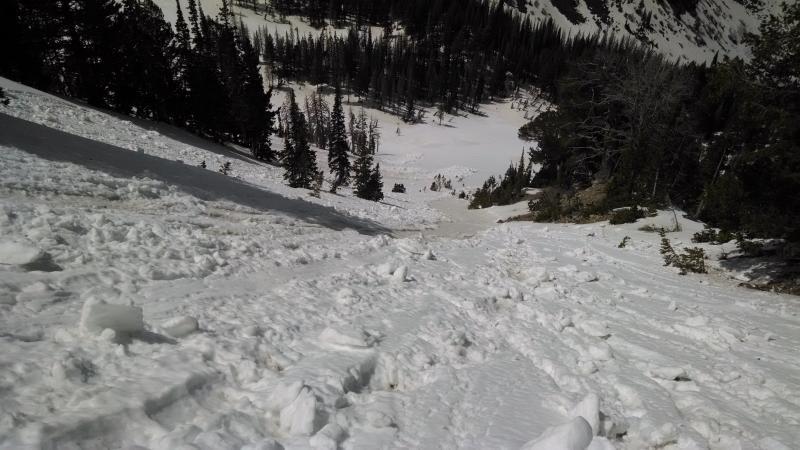
typical steep slopes today with avalanche tracks and debris. You can see the new white snow contrasted with the brown snow that forms the tracks. The old brown snow did not, in general, avalanche. Many times these tracks provided the best skiing, since it was actual corn, and not the dense newer wet "powder".
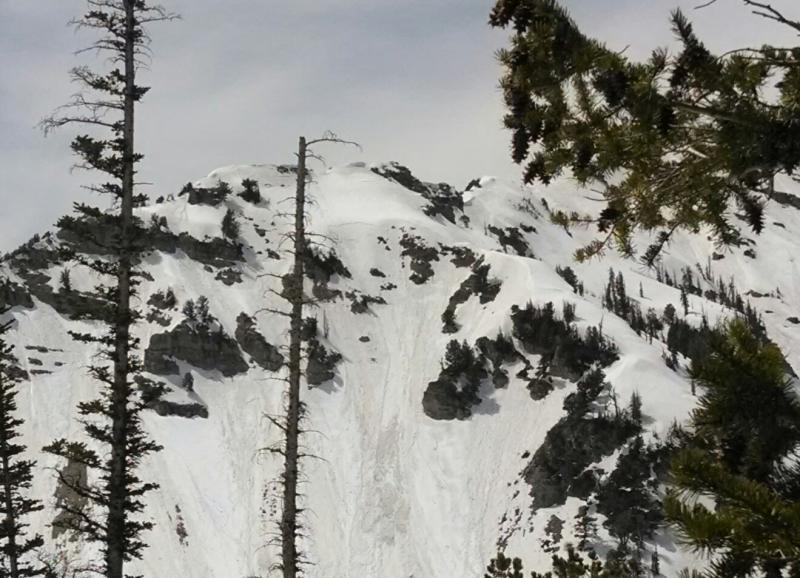
If you look closely, you can see the crown of the shallow slab in the center of this picture. The elevation is about 10,000 feet.
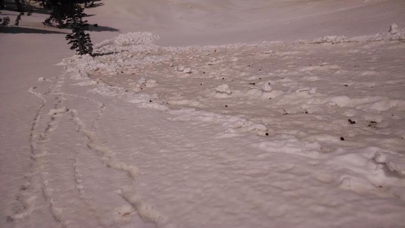
This is a picture of the ubiquitous avalanche debris, and also a section of "newer" snow that skied well.
Today's Observed Danger Rating
Low
Tomorrows Estimated Danger Rating
Moderate