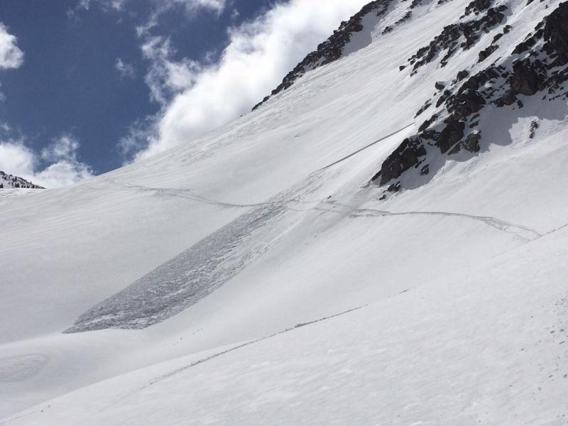
Route today was White Pine drainage to Lake Peak and Lake Chute. Evelyn's forecast was spot on - the only hazards we were identifying were small pockets of fresh wind drifts at mid and upper elevation aspects. These were somewhat sensitive and would crack around your skis. Quite easy to identify and manage. Exiting Lake Chute and wrapping around through North-facing Boulder Basin my partner triggered a class 1 soft slab as we were traversing a steeper North facing aspect. 20 meters (60') wide, 50 meters vertical. Crown was 20-30 cms (8-12"). This was exactly the type of terrain Evelyn was pointing out in her Saturday forecast. The weak layer was re-crystallized snow at the new/old snow interface. For those keeping score SS-ASu-D1/R1-I. To somewhat paraphrase from Aaron Rice's super nice observation from Monte Cristo, this was a manageable hazard in manageable terrain.
I would not be surprised to hear several stories of these types of skier-triggered fresh wind slabs by the end of the day on Saturday. However, I think a significant majority of the terrain is not wind loaded and has a Low danger.
No warming on the snow surface while we were out this morning. Perhaps a Moderate hazard for Sunday with any lingering wind slabs and warming on solar aspects.