Couple of snow nerds out for a morning of comparing field notes and techniques. Overall found very stable snowpack in Hidden Canyon/Peak 10,420' area of Brighton backcountry. I have not been in this area this season, but was finding a 2 meter snowpack that was largely rightside up with depth hoar/facets down near the ground showing continued signs of strengthening due to compression and lack of temperature gradient. Also interested to see how the lighter-density snow that came in at the onset of the storm on Thursday 2/27 was behaving. This density inversion is now buried 30-40 cms down from the snow surface, with locally higher depths in areas that were wind-loaded. Stability tests showed a largely healed layer with CT 20/Q2 down 35 cms at the density inversion, and ECTN19/Q3 failing just above the density inversion down 30 cms. These are similar results to what I was getting on Sunday in upper LCC. Beneath the density inversion is a cohesive slab that quickly goes from 4F to 1F hardness, with a 15 cm layer of 4F rounding depth hoar near the ground. This is only one data point, but it is the strongest snow I have seen outside of upper LCC this season.
Snow profile is generalized view of snowpack on NE aspect at 10,300'
Video is of discussion of current snowpack in Brighton backcountry.
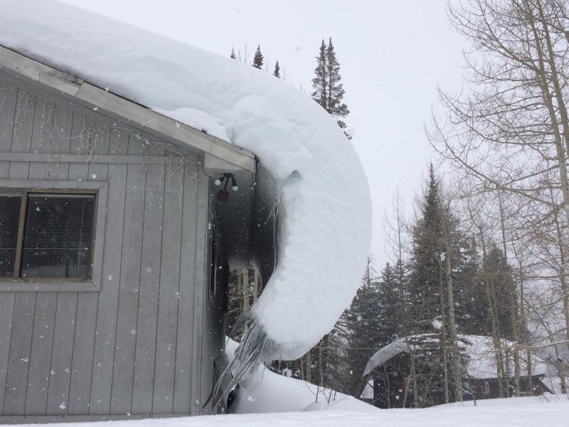
Noticed this creep and glide of snowpack on roof above Brighton circle. Nice demonstration of elasticity of snow. [UPDATED - Tom Kimbrough correctly pointed out this is not "elasticity" of snow, but rather "ductility']
Excellent work by Tom Diegel with piece on companion rescue - thanks Tom!


