Observation Date
3/2/2014
Observer Name
Bruce Tremper
Region
Salt Lake » Little Cottonwood Canyon » White Pine
Location Name or Route
White Pine day off skiing with friends
Weather
Sky
Scattered
Wind Direction
West
Wind Speed
Light
Weather Comments
Beautiful day with scattered clouds and dappled sunshie. Not too warm, not too cold.
Snow Characteristics
Snow Surface Conditions
Dense Loose
Snow Characteristics Comments

Snow was delightful, dense, creamy graupel and rimed snow that rode fast on lower angled terrain. Snow was wet below 8,000'.

Red Flags
Red Flags
Recent Avalanches
Avalanche Problem #1
Problem
Persistent Weak Layer
Problem #1 Comments

It was nice to see that we indeed had some deep slabs out of the last storm, as we suspected we would see, in shallow, rocky areas. The photos of the two avalanches I have here have been reported by others today but I'm sending photos from a different angle. They most likely occurred during the very high wind, high precipitation intensity and warm temperatures on Friday night or Saturday morning.

These are all low probability / high consequence avalanches that would probably be hard for people to trigger. The place where you would most likely trigger them would be a shallow, rocky area where the slab is still thin and the depth hoar is the weakest.

Avalanche Problem #2
Problem
Wet Snow
Problem #2 Comments

Since al the new snow seem to have settled out after the widespread storm slabs on Friday, the next phase will be when it gets wet. With forecasted warmer temperatures and possible sun these next few days, we will have to keep an eye out for wet activity from both warm temperatures and hot, springtime sun.

Comments

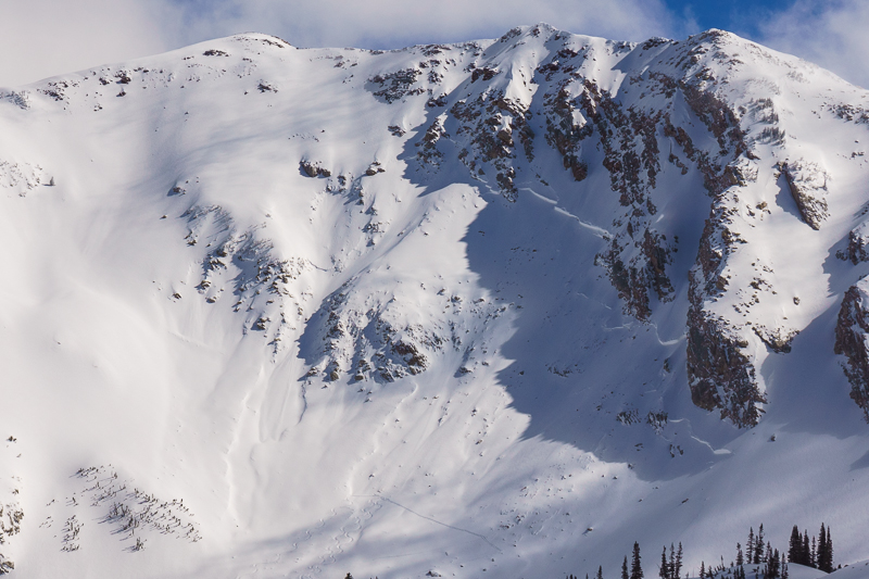
Another angle on the deep slab avalanche off the northwest side of Red Baldy into White Pine.

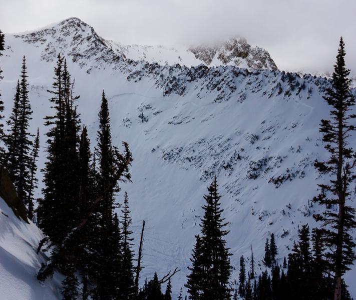
Here is a photo of the large avalanche off the east facing slope above Red Pine Lake. I took this photo from the ridgeline between Red Pine and White Pine. I agree from the looks of both of these avalanches that they probably occurred early on Saturday March 1st or perhaps late Friday night with the howling wind, high freezing levels and high precipitation rate.

Today's Observed Danger Rating
Moderate
Tomorrows Estimated Danger Rating
Moderate