Had the good fortune to be out Friday/Saturday/Sunday in a variety of terrain in the central Wasatch. On Friday the density inversion at the old snow surface was the weak layer. Many naturals and skier-triggered slides. On Saturday the density inversion was already healing, but strong wind loading at the upper elevations made things less manageable than Friday. I was still identifying the density inversion along BCC/MCC ridgeline, but shears were becoming more stubborn. Several quick pits today on a variety of aspects between 9000 and about 10,500' showed a largely healed density inversion, and the slab on top was relaxed. Ski cuts on several steep test slopes on North and Northeast aspects produced no results. Would call the hazard Moderate, with wet activity on solar aspects the most likely hazard if the sun does appear.
It seemed that by mid to late February (after the Feb 13-16 storms), the persistent and deep slab issues went away in the central Wasatch as the deep, dense storm snow both bridged as well as compressed the buried facets. The persistent weak layers now buried 1.5 - 2.0 meters deep have strengthened due to compression and removing the temperature gradient. In addition, the modest thump given to the snowpack over this past weekend only produced slides within the storm snow (at least from what I am aware of.)
To me it seems the deep slab instability issues in the central Wasatch are largely put to rest until we go through our first significant warm up of the emerging Spring season.
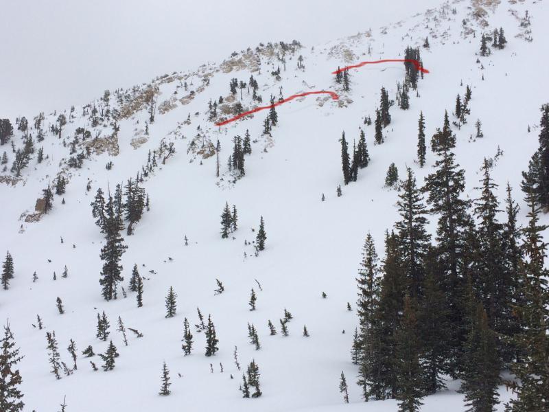
Am including a photo from Northeast facing Sunset Peak taken from bottom of Catherine's Pass area. This was likely a natural, D2 slide with debris that ran almost to Lake Catherine. Perhaps this has been reported, but am guessing it occurred sometime during the day on Friday. Very consistent aspect, elevation, and slope angle with respect to other activity reported from Friday. (Poor lighting so highlighted just above crown.)