Observation: Mineral Fork

Observation Date
2/19/2014
Observer Name
Kikkert
Region
Salt Lake » Big Cottonwood Canyon » Mineral Fork
Location Name or Route
Mineral Fork
Weather
Sky
Overcast
Precipitation
Light Snowfall
Wind Direction
West
Wind Speed
Moderate
Weather Comments
Just out for a quick morning, mostly before the cold front came through. Cloudy, with ridge top winds sustained 20-30 mph. Occasional strong gusts were also swirling down into the canyon. Some very light snowfall beginining around 930 am.
Snow Characteristics
Snow Characteristics Comments

About 3 inches of graupel above 8,200' that made for fast fun skiing on the low angle, below 8,200 feet mostly supportable crust.

Red Flags
Red Flags
Wind Loading
Poor Snowpack Structure
Red Flags Comments
Wind loading along the exposed ridge lines was the most obvious red flag, with loading limited primarily to the lee of exposed ridges. Some swirling of the winds down into more protected terrain was occuring, but given the dense nature of the surface snow not much cross loading going on.
Avalanche Problem #1
Problem
Persistent Weak Layer
Problem #1 Comments

Would expect wind slabs in the normal places tomorrow, primarily east facing slopes. Given that the storm mostly fizzled, and the snow on the surface prior to any new snow was denser, would expect any wind slabs to be relatively thin, but perhaps a bit hard. Also, given the wind buffed surface prior to this storm would expect that any wind slabs would not be overly sensitive. I would say they would be in the "manageable" category, except that any wind slabs running in terrain that has not avalanched could cause something to step down into a larger avalanche, so probably not worth messing with.

Avalanche Problem #2
Problem
New Snow
Problem #2 Comments

Took a quick look at deeper, faceted weak layers on a NE slope at approximately 9,000'. Snowpack was still a bit shallower than in more upper elevation and upper canyon areas, 155 cm. Approximately 70 cm of February snow above the early season facet layers. Failure in stability tests on facets from late Dec/early Jan only, with no propagation in ECT (see pit profile). Shears were not clean, indicating some healing of these layers beginning to occur. However, poorer structure here than in upper BCC where I have been lately, and not ready to test anything big yet. Also, although snowpack was thinner here, with less than a meter of slab above the week layers, traditional stability tests becoming less effective (didn't do a PST, would be interesting to see). Would want to see consistent "good" results across a broad range of aspects and elevations first.

Snow Profile
Aspect
Northeast
Elevation
9,000'
Comments

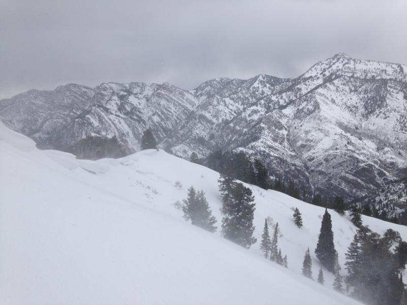
Photo below showing wind loading onto east facing slopes prior to the cold front, with the crown from the slide triggered by Trent et al. on the 11th in the background.

Today's Observed Danger Rating
Considerable
Tomorrows Estimated Danger Rating
Considerable
Coordinates