Observation Date
2/17/2014
Observer Name
Ted Scroggin
Region
Uintas » Bear River Ranger District » Whitney Basin
Location Name or Route
Whitney Basin-Cherry Hill, Super Bowl
Weather
Sky
Broken
Wind Direction
Southwest
Wind Speed
Strong
Weather Comments
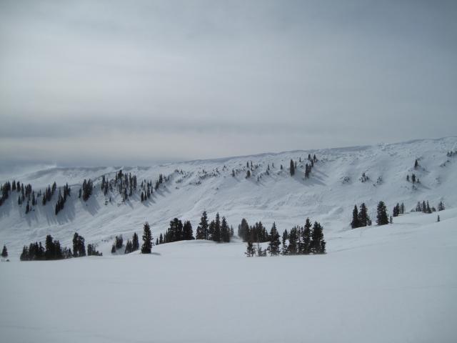
Mostly high clouds and filtered sun with strong southwest winds all day even into the lower elvations. Yesterdays new snow was blowing around easily into sensitive wind drifts.
Snow Characteristics
New Snow Depth
5"
New Snow Density
Medium
Snow Surface Conditions
Powder
Wind Crust
Melt-Freeze Crust
Snow Characteristics Comments
Around 5-6" new snow from yesterday's quick storm which helped to cover-up some of the old tracks and freshen things up. Todays's winds were quite strong from the southwest and was easily blowing this new snow into new wind drifts. In very protected areas the riding and turning conditions are good on a mostly supportable base at the higher elevations.
Red Flags
Red Flags
Recent Avalanches
Wind Loading
Poor Snowpack Structure
Red Flags Comments
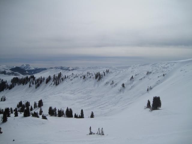
Today's big red flag was the strong winds moving lots of snow around and loading slopes that generally face north through northeast, east and southeast.
Avalanche Problem #1
Problem
Persistent Weak Layer
Trend
Same
Problem #1 Comments
Strong winds from yesterday and today have created some heavily wind loaded slopes that generally are north through northeast and east facing slopes. I observed one fresh wind slab that released naturally in the upper Whitney Basin.
Avalanche Problem #2
Problem
Persistent Weak Layer
Trend
Same
Problem #2 Comments
Looking around the area today, some steeper slopes did have some sled tracks on them from the weekend, but I did not observe any recent triggered slides. Given the large avalanches that have been happening this past week, I would not say that things are good to go. A person just needs to find that weak spot on the slope and it's very likely a large avalanche can be triggered.
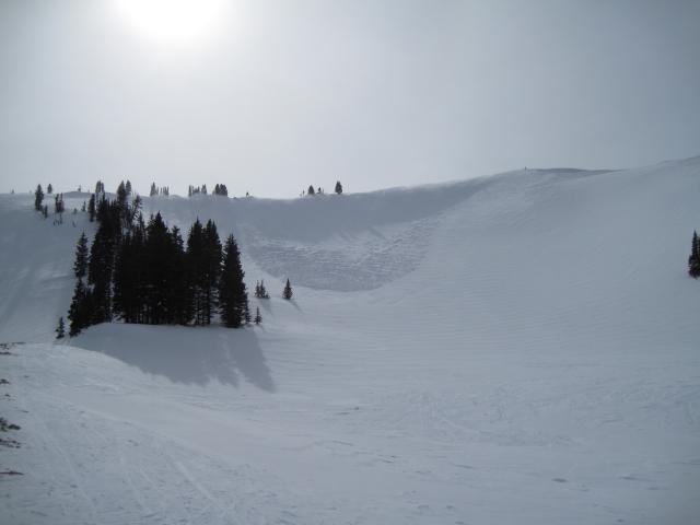
This large avalanche in Super Bowl on an east facing slope may have been triggered by a cornice fall. I'm not sure on the exact day, but would guess it occured this past week when many other large avalanches were happening. It broke quite wide and looks like it also broke into old snow judging from the crown depth.
Fresh wind slabs have been forming on the leeward slopes and I noticed this fresh wind slab that released naturally from strong steady winds.
Today's Observed Danger Rating
High
Tomorrows Estimated Danger Rating
Considerable