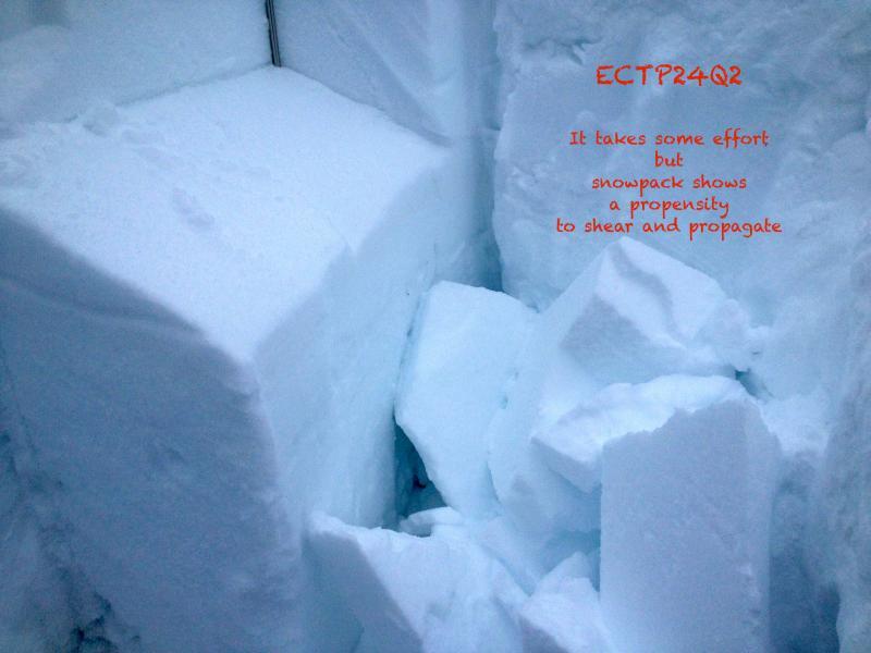
Observation Date
2/16/2014
Observer Name
jg
Region
Uintas » Upper Weber Canyon
Location Name or Route
Upper Weber Canyon
Weather
Sky
Overcast
Precipitation
Moderate Snowfall
Wind Direction
West
Wind Speed
Moderate
Weather Comments
Upper 20's at the trailhead in the morning with light to moderate west winds. The front rolled throught around noon with slightly dropping temps, moderate to heavy snowfall and strong winds. Even off the ridges the winds were active. Generally from the west, the winds were also coming from the NW and even E at times. Periods of heavy snowfall and graupel and very strong winds. Started to break up around 5:00 pm.
Snow Characteristics
New Snow Depth
3"
New Snow Density
Medium
Snow Surface Conditions
Powder
Dense Loose
Wind Crust
Melt-Freeze Crust
Rain-Rime Crust
Damp
Snow Characteristics Comments

A nice mix of snow conditions today. Lower elevations were a mix of crusts and damp snow. Soft snow above about 9K. 2"- 4" of new snow during the day depending on elevation. Winds were affecting the snow at all elevations, cross-loading slopes, creating wind skins and soft slabs.

Red Flags
Red Flags
Recent Avalanches
Heavy Snowfall
Wind Loading
Poor Snowpack Structure
Red Flags Comments
Wind was moving a lot of snow today
Avalanche Problem #1
Problem
Persistent Weak Layer
Trend
Same
Problem #1 Comments

Winds moving a lot of snow today at all elevations.

Avalanche Problem #2
Problem
Persistent Weak Layer
Snow Profile
Aspect
Northwest
Elevation
10,000'
Slope Angle
31°
Comments

ECT results.

Signs of recent activity.

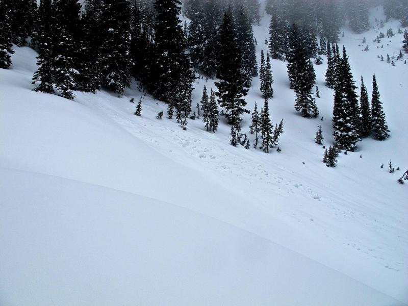
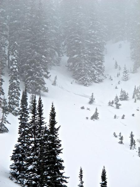
Traveled from 7400 -10,500, north half of the compass.

To me, to snowpack seems to be adjusting to the weight of the last storm cycle, however, today's winds and snow will put an additional strain on the pack, especially on wind loaded slopes. Personally, I am avoiding slopes with an easterly component to it's aspect and watching slope angles carefully on slopes facing the north half of the compass. Pit results still reflect high consequence if you do trigger a slide, as they are breaking on deeper buried layers. Also, slides stepping down to deeper weak layers are also a concern.

Same to decreasing danger as high pressure moves in. Additional wind or snow will be a factor as well as the sun on Monday and Tuesday.

Today's Observed Danger Rating
High
Tomorrows Estimated Danger Rating
High