Observation Date
1/30/2014
Observer Name
jg
Region
Uintas » Upper Weber Canyon
Location Name or Route
Upper Weber Canyon
Weather
Sky
Overcast
Precipitation
Light Snowfall
Wind Direction
Northwest
Wind Speed
Light
Weather Comments
Light snowfall but not much accumulation throughout the day, about an inch while I was out. Winds were very light and generally out of the northwest. Low to mid twenties at 9K, mid teens at 10K. Low cloud ceiling at times obscuring views.
Snow Characteristics
New Snow Depth
9"
New Snow Density
Medium
Snow Surface Conditions
Powder
Snow Characteristics Comments

The new snow fell right side up for the most part. The last inch of snow was slightly more dense and there were rimed stellars on the surface of the snow. I noted a light rain crust up to 9500+ ft., although it was not noticeable skiing. About 1" of water out of the storm in the area I traveled.

Red Flags
Red Flags
Wind Loading
Cracking
Poor Snowpack Structure
Red Flags Comments
Cracking in the new snow while breaking trail. Wind loading on NE facing slopes. Same ole, same ole with the the overall structure of the snowpack.
Avalanche Problem #1
Problem
New Snow
Trend
Decreasing Danger
Problem #1 Comments

On steeper slopes I could get the new snow to sluff pretty easily. Some sluffs traveled far but really did not entrain that much snow. I would image those instabilities will settle out overnight.

Avalanche Problem #2
Problem
Persistent Weak Layer
Trend
Same
Problem #2 Comments

Deep slab/persistent slab - This is the one to watch.

Comments

Limited views today but I did notice this new snow avalanche on a steep east facing slope.

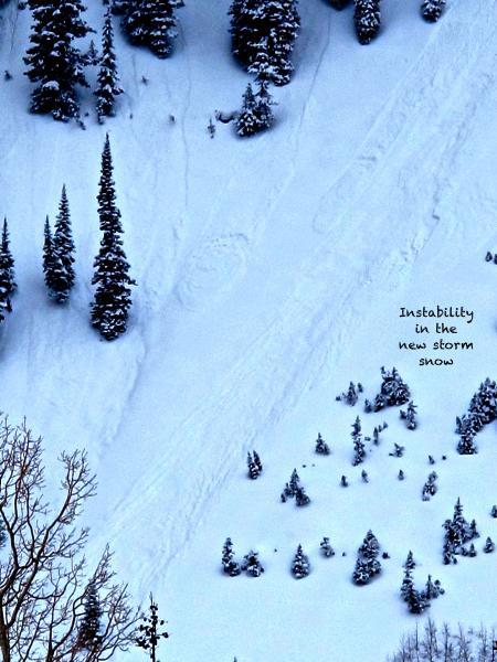
Second photo of new snow sluffs.

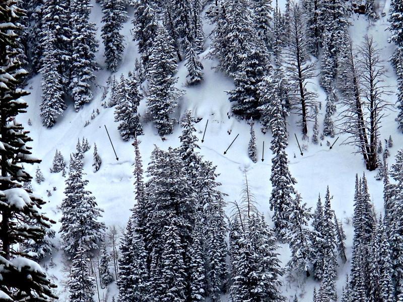
Traveled form 7400 - 10,400 ft., north half of the compass, slope angles to 32°.

Other then quick hand pits I did not perform any stability tests. Views were limited so I was not able to have a good look around for signs of a natural avalanche cycle. I mostly just walked and skied today while I poked around in the snow. I did notice the rain before the storm capped some weak snow and was present up to at least 9500 ft.. The rain crust is not stout but it is noticeable. The weak snow underneath the rain crust may be a concern in the future. I am looking forward to doing some stability tests in the next few days.

It doesn't look like we will get that much more snow and winds aren't expected to blow that hard. Not sure if the inch of water will tip the scale.

Where I traveled I would consider the danger moderate. I'm still erring to the side of caution and avoiding any steep wind loaded slopes, especially slopes on the north half of the compass with an easterly aspect.

Today's Observed Danger Rating
Considerable
Tomorrows Estimated Danger Rating
Considerable