Observation Date
1/14/2014
Observer Name
Hardesty and O'Connor
Region
Salt Lake » Mill Creek Canyon » Wilson Fork » Wilson Glade
Location Name or Route
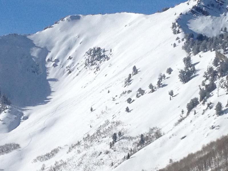
Spruces to Reynolds, Soldier and Wilson
Weather
Sky
Few
Wind Direction
North
Wind Speed
Light
Weather Comments
Just enough lingering rh and light wind for patches of surface hoar, now capping Monday's thin rime crust.
Snow Characteristics
Snow Surface Conditions
Rain-Rime Crust
Snow Characteristics Comments

Rime Crusts: Friday night's 2-3mm rime crust now buried up to a foot deep in some locations; in other areas winds had stripped the last few day's snow and was again exposed. But primarily, most snow surfaces held the 1mm rime crust from (yesterday) Monday.

A quick word on these crusts - with the ridge parked over the Pacific (and way too often overhead), it seems that so many of our "storms" and brush-by disturbances have been from the northwest, effectively sliding down the eastern edge of the ridge (imagine something similar to the parabola Brett put on the forecast for today). This is "garage meteorology", but we'll see alternating cold and warm air advection (horizontal movement of an air mass) patterns with this northwest flow (but getting to point here for riming, look for gradually warming temps along the 700mb heights, quite common during the end of the precipitation period), with the warm 'front' the purveyors of the super-cooled water droplets...frequently deposited as rime. Often annoying to ride through, they can also foment the development of facets above and below the crust (beyond the scope of this)...but not always. In any event, we'll be keeping an eye on these crusts over the next couple of weeks.

Red Flags
Red Flags
Recent Avalanches
Wind Loading
Poor Snowpack Structure
Red Flags Comments
Arguably persistent slab in Mill Creek terrain (and many portions of Provo); deep slab to the south in the Cottonwoods...(and clearly to the north in Ogden and Logan). Just pockets of naturals, or cornice-induced naturals noted off the Gobbler's/Alexander ridgeline...perhaps 18-24" deep and maybe 50' wide here and there; some just off the ridgeline, some well below; but again pockety. Difficult to tell, but perhaps Depth Hoar Bowl in its entirety had run (well covered up by new snow/wind)? Perhaps Fred could tell - I think he was in there today - .
Avalanche Problem #1
Problem
New Snow
Problem #1 Comments

But it was not to be...no cracking, collapsing, remote triggering or otherwise initiation with ski or slope cuts. This was our sense after walking from Reynolds to Soldier to Wilson - that seemed to have been a bit more protected than the Gobbler's/Alexander ridge. Quick test pits showed not much slab/reactive load above the now enmeshed early Nov/late Nov faceted snow there in areas of Mill Creek, particularly in sheltered terrain.

Comments

Savvy folks avoiding the persistent slab on steep south facing terrain (where not present or reactive), but then on east facing terrain below, staying on lower angled slopes -

Danger rating below - perhaps Moderate with pockets of Considerable; still, it doesn't affect my travel choices whether it's Moderate or Considerable...I'm just looking to see what held the most wind/load from these last storm events.

Travel recommendations -

Unmanageable avalanche conditions associated with a high level of uncertainty. Extra Caution is advised. Test slopes, ski cuts, previous tracks, and cornice drops often provide little information on stability. Typically confined to particular aspects and elevations (as depicted in the current avalanche forecast). Avoid this terrain or choose slopes gentler than 30 degrees in steepness with nothing steeper above. Remote triggering possible, even from the valley below. Give runout zones a wide berth.

Today's Observed Danger Rating
Considerable
Tomorrows Estimated Danger Rating
Considerable