Observation Date
12/21/2013
Observer Name
Ted Scroggin
Region
Uintas » Bear River Ranger District » Gold Hill
Location Name or Route
Gold Hill Basin
Weather
Sky
Obscured
Precipitation
Light Snowfall
Wind Direction
Northwest
Wind Speed
Light
Weather Comments
About 3" new snow from last night and throughout today. Fairly light northwest winds and some clearing late in the afternoon.
Snow Characteristics
New Snow Depth
3"
New Snow Density
Low
Snow Surface Conditions
Powder
Snow Characteristics Comments
Riding conditions are slowly improving, but I felt I was still riding on the ground and things felt punchy.
Red Flags
Red Flags
Recent Avalanches
Cracking
Collapsing
Poor Snowpack Structure
Red Flags Comments
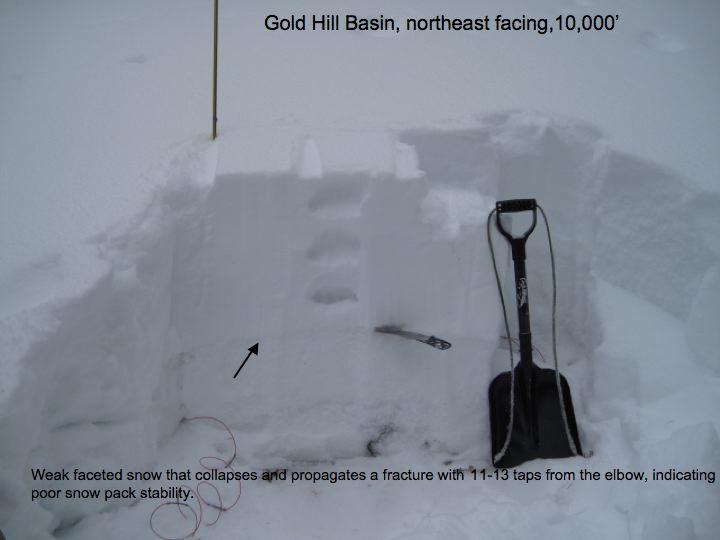
Lots of collapsing as I traveled around and the snow pack is still weak with poor stability.
Avalanche Problem #1
Problem
New Snow
Trend
Same
Problem #1 Comments
It does not look like the persistent weak layers are going away anytime soon. Some of the energy in the snow pack has relaxed, but it is still quite easy to collapse the weak layer.
Avalanche Problem #2
Problem
Persistent Weak Layer
Trend
Decreasing Danger
Problem #2 Comments
Isolated to the higher ridgelines, the recent wind slabs are cracking and collapsing under the additional weight of a person.
Comments
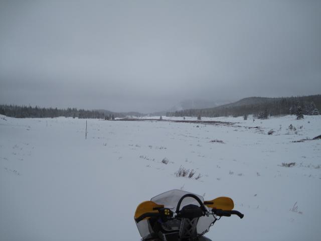
1. The approaches to the mid and higher elevation riding areas are still thin and brushy.
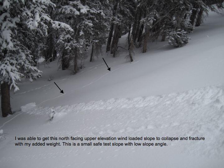
2. On this test slope, I was able to collapse the weak layer and fracture the slope from a thin shallow spot.
Still not that much snow in the Gold Hill area and poor snow pack stability.
Today's Observed Danger Rating
Considerable
Tomorrows Estimated Danger Rating
Considerable