Observation Date
12/13/2013
Observer Name
Ted Scroggin
Region
Uintas » Bear River Ranger District » Gold Hill
Location Name or Route
Gold Hill Basin
Weather
Sky
Obscured
Precipitation
Light Snowfall
Wind Direction
Northwest
Wind Speed
Light
Weather Comments
Mostly cloudy start to the day, with snow and wind beginning around 11:30. About 1-2 inches of new snow accumulated during the afternoon.
Snow Characteristics
New Snow Depth
2"
New Snow Density
Low
Snow Surface Conditions
Dense Loose
Faceted Loose
Wind Crust
Snow Characteristics Comments
Many areas had some firm wind board from Tuesday's wind, but sheltered terrain had some decent settled powder conditions.
Red Flags
Red Flags
Wind Loading
Collapsing
Poor Snowpack Structure
Red Flags Comments
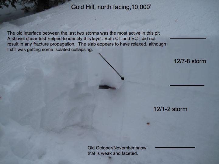
The collapsing I observed was more localized than widespread with no cracking observed. The winds were on the increase as the afternoon went on and little new snow accumulation. In my travels I felt the slab was somewhat relaxed, I had no fracture propagation, but the interface between the last two storms is still noteworthy and reactive with a shovel shear test.
Avalanche Problem #1
Problem
New Snow
Trend
Same
Problem #1 Comments
Around the Gold Hill Basin, I was not finding the slab to be very reactive, but in steep thin rocky terrain I would suspect conditions are somewhat different.
Avalanche Problem #2
Problem
Persistent Weak Layer
Trend
Decreasing Danger
Problem #2 Comments
Winds were picking-up this afternoon and with loose snow to blow around fresh wind drifts will be found along the ridgelines.
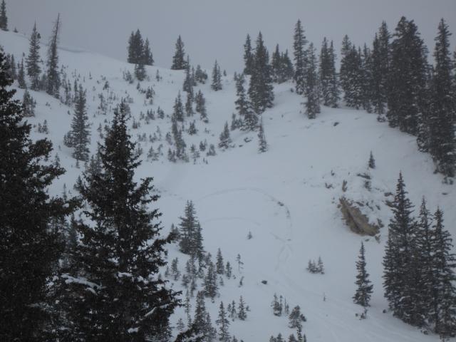
Old news, but looking around Gold Hill this place looked to have gone through a nice little natural avalanche cycle from the last storm. Photos did not show it very well, but some shallow crowns and lots of slumping and sluffing were evident. Steep, thin, rocky terrain was the common theme with this activity, in the photo just above the sled tracks is some old activity.
Today's Observed Danger Rating
Moderate
Tomorrows Estimated Danger Rating
Moderate


