Cruised up along Patsy Marley ridgline this morning (after making the obligatory viewing of the Michigan City terrain trap slide from Monday). I often cruise this ridgeline early in the season (try to at least once per week) as it provides easy access to lots of north & northeast terrain. I have several sites where I regularly dig pits and it allows me to monitor weak layers. The poor snowpack structure we have is well-documented, and knowing that, today I wanted to get an idea how the buried facets have adjusted to the storms from 12-2/12-3 and 12-7. There have been numerous avalanches on northerly aspects above about 9200' over the past several days, and my pits today showed a continued, sensitive persistent slab ranging on top of the faceted layers that formed in late October and through much of November. Dug three different pits today, all on NE aspects > 9800' and steeper than 30 degrees. Extended column tests on each pit had full propagation, with Q1 quality. The lowest score was ECTP3, the highest ECTP16. Last week I was finding the faceted layer that formed over Thanksgiving week (and was buried underneath the 12-2/12-3 storm) to be the greatest concern. Today I was noticing that in thinner snowpack areas, the ~45 cm (1.5') slab from the two December storms has been enough to activate the basal facets in the bottom 30 cms of the snowpack. One pit on a slope with 75 cm snowpack failed at ECTP3 Q1, failing in the basal facets. However, in areas where the snowpack approaches a meter, I was getting failures in the Thanksgiving facets. Regardless, from my observations, the persistent weak layers have an energetic slab on top. Looks like a 5-lemon snowpack. I'd continue to call the hazard Considerable in upper elevation northerly aspects.
Faceted grains that formed in November.
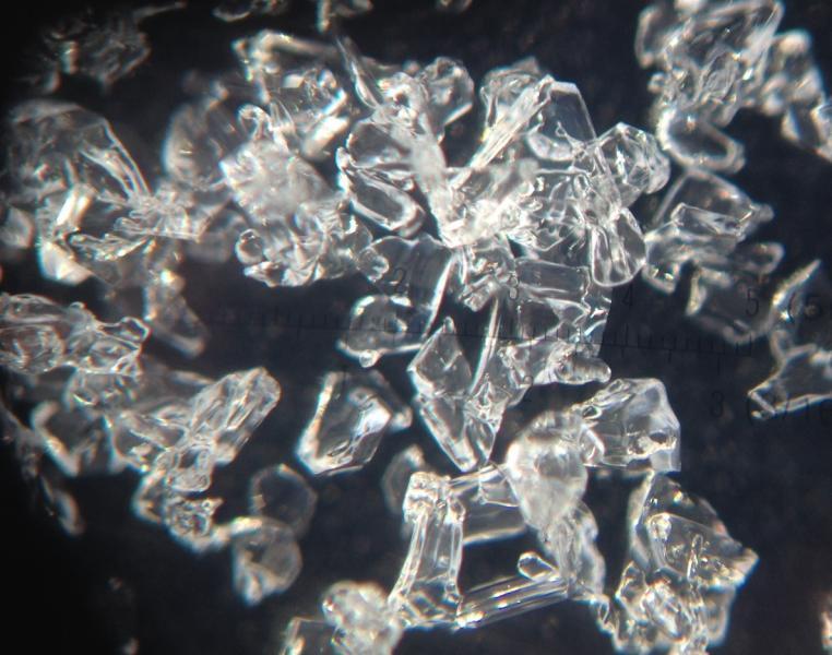
Surface hoar (5 mm).

Video of most stubborn extended column test today (thanks to Joe Lohr for taking the video)


