Quite a nice treat! Superb ski conditions with a right-side up storm. Outside of wind-affected areas I was able to trigger several small sluffs in steeper terrain. These were only 5-10 cms thick, but they were running fast and far with some debris piles up to thigh-deep. However, just like the wind slabs, these were very easy to manage and it is awfully fun to ski steeper terrain with a little bit of snow sluffing around you. Would only be concerned if the sluff would leave you in a terrain trap or could push you over a cliff or rock band.
Otherwise, a few quick hand pits in upper elevation northerly aspects shows the new snow sitting atop a 1-2 cm thick melt-freeze crust with dry snow underneath. I haven't skied in the Wasatch in a week, but it appears to me the upper elevation north aspects are still sporting a late winter snowpack.
Sun was beginning to peak out when we were exiting south-facing aspects from Cardiff Pass, although the cold winds were preserving the snow surface. My hunch is that northerly aspects will still hold cold, dry powder for Wednesday morning.
I would call the overall hazard Moderate with risks being loose snow sluffs on steeper aspects and wind loading on upper elevation aspects, particular those facing South through West.
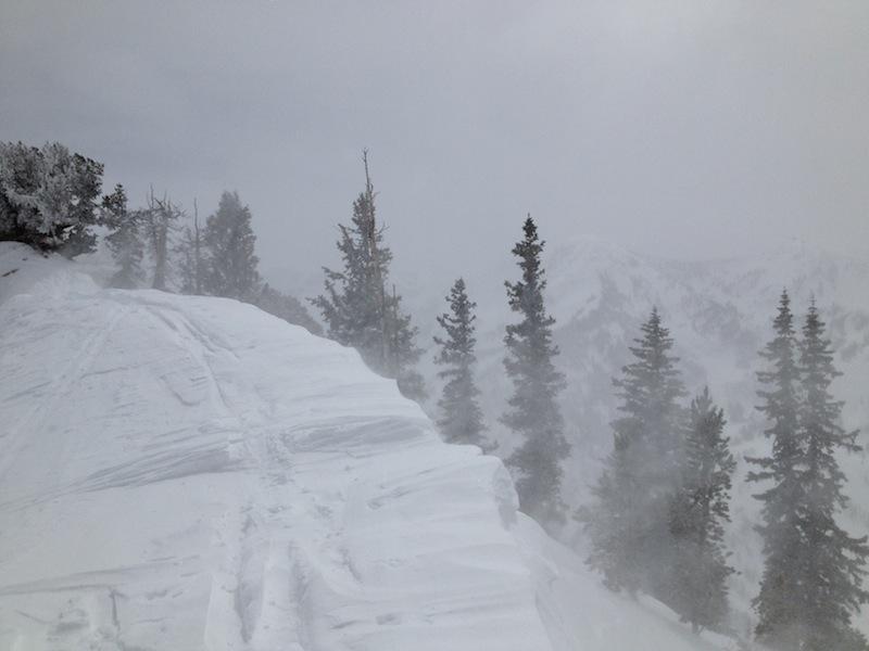
This photo taken along LCC/BCC ridgleline shows the wind loading from the N/NE winds. These have created wind loading in areas that we are typically not used to seeing this occur, as well as some cross loading at mid-elevations.
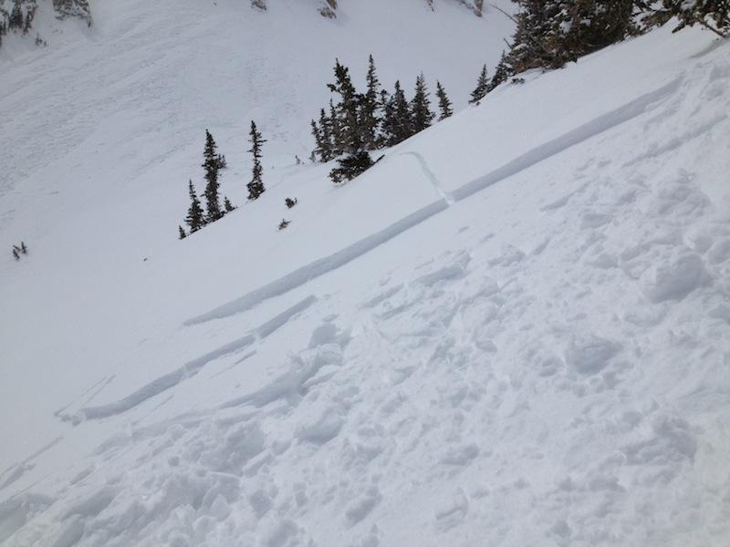
I ski cut this obvious wind-loaded slope at a convex rollover on a South aspect 500' below the BCC/LCC ridgeline. This was typical of the wind loading I was finding today - 1F hardness, 10-15 cms thick, propagated approximately 15 meters (~50').