Observation: Porter Fork

Observation Date
3/25/2013
Observer Name
Fred
Region
Salt Lake
Location Name or Route
Porter Fork to Raymond north face
Weather
Sky
Few
Wind Direction
Northwest
Wind Speed
Light
Weather Comments
Scatterd clouds kept the sun at bay unitl aobut 11:30 then intese sun would poke through. Large clearing at 2pm alowed solar damage to all slopes unless protected by shade. Snow became somewhat damp at all elevations for me today (6k to 9k) however I did not encounter any free water in the snow pack until about 7k in the afternoon.
Snow Characteristics
New Snow Depth
12"
New Snow Density
Low
Snow Surface Conditions
Powder
Snow Characteristics Comments

Snow depth ranged from 10" to 15". Some areas of slight wind damage. Sad to say that even on direct north facing the snow did become somewhat damp in the afternoon today. There was just not enough wind and or cloud to hold off the sun.

Red Flags
Red Flags
Rapid Warming
Red Flags Comments
Rollers and fresh sluffage on any pitched surface that had any hint of east or west aspect to it.
Avalanche Problem #1
Problem
Wet Snow
Problem #1 Comments

Wet sluffs with potental to become larger with more heating.

I found two distinct crust layers which could act as a surface for water to run on if the heat wave continues.

Comments

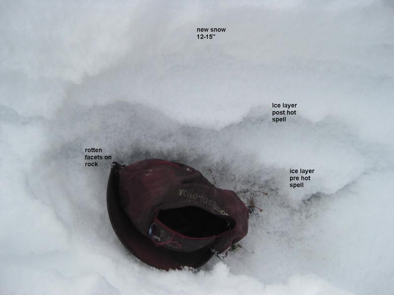
Pit dug at the top of piece of pie showing two ice layers below the fresh snow with large rot near the ground.

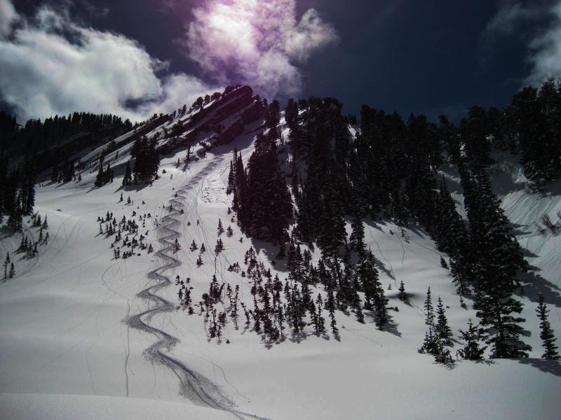
The rollers next to the ski track showing dampness in the new snow on even direct north facing.

Would expect all this to be moot b/c with rapid heating in the forecast all the fresh snow will be baked quickly if it has not already happened.