With snow and wind in the forecast, was interested to see how upper LCC looked prior to the anticipated stormy period. No detailed pits, but lots of quick hand pits, ski cuts, cornice kicks, and examining the interface of the storm snow to the old snow surface. I was out on Thursday morning and it was quite easy to get the new snow to sluff, as well as several natural sluffs were observed. (Mark White had some excellent photos of this from Cardiac Ridge.) Today it was much more difficult to get the new snow to sluff as it appeared to begin to sinter. However, on steeper aspects where I was finding the new snow sitting on top of weak facets, it was quite easy to get a soft slab to gouge down to the weak faceted snow about 30 cms down.
Currently I would rate the hazard mostly Low with pockets of Moderate where there was recent wind loading or sluffing in the new snow. The old wind slabs that were formed 3-7 days ago seem to be lacking any energy right now and the new snow didn't add enough weight to the snowpack to affect stability. But this is possibly going to change .....
With respect to the expected snow and wind, I am finding a few areas of concern:
1. There is 20-30 cms of very light density snow available for transport on all aspects.
2. There are several pencil-hard wind slabs at mid and upper elevations and appear to mostly be on northwest through north aspects, although I imagine they could also be found elsewhere. On solar aspects there are sun crusts of varying thicknesses. The light-density storm snow from the past 48 hours is sitting on top of these crusts and it is possible the hard crusts can provide a bed surface, and the light-density snow the weak layer. Strong winds and/or new snow will provide the slab.
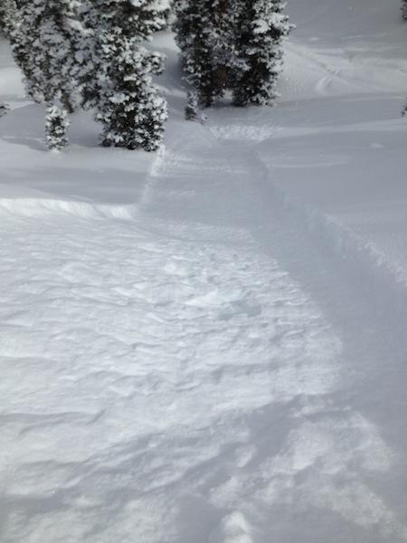
3. In terrain where I wasn't finding crusts or wind deposited snow, there is faceted snow sitting underneath the storm snow and it was very easy to get soft slabs to fail on the layer of faceted snow down about 30 cms. (Photo.)
4. In some rocky areas where there was a thinner snowpack, the snowpack was quite weak with facets, depth hoar, and cavity hoar.
I'm obviously no Trent Messenheimer with the video, but an attempt at describing how the light-density new snow on top of old wind crusts can provide the weak layer/bed surface combo.
This certainly wasn't nominated for an Oscar, but an attempt at illustrating the weak snow seen in thinner snowpack areas.


