Observation: Skyline

Observation Date
12/7/2012
Observer Name
Darce Trotter/ Steve Cote
Region
Skyline
Location Name or Route
above huntington reservior
Weather
Sky
Obscured
Wind Direction
Southwest
Wind Speed
Moderate
Weather Comments
summit ridge was fogged in all morning, visibility 50', but at least the wind was blowing. temps have been in the 20's last couple of days at the summit, but warmer in lower elevations. It is December above 9000', October below that. We had planned to walk south on the Summit Ridge to the top of Rolfson Canyon because you have to stay high to stay on the snow. Decided with low vis we would work our way up from above Huntington reservoir as high as we could get and still see what we were looking at
Snow Characteristics
New Snow Depth
2"
New Snow Density
Medium
Snow Surface Conditions
Wind Crust
Melt-Freeze Crust
Snow Characteristics Comments
whopping total of 2" new at Miller Flats, rained up to 9500' with the quick hitting blizzard, so you have a breakable crust everywhere down about 2"-3" with graupel and wind skin/slab at the surface. I said last week things could not get worse, but they have. Seems as though the weather has remained north of Point of the Mountain this winter, Provo Mountains cannot be much better until you get above 10,000'
Red Flags
Red Flags
Poor Snowpack Structure
Red Flags Comments
no load, no hazard, we now have a wind crust, graupel layer, rain crust, and faceting crystals just waiting for a load, but the way this season is going, don't know when that will happen.
Avalanche Problem #1
Problem
Wind Drifted Snow
Trend
Same
Problem #1 Comments
as i said, no load, no danger, but things could change
Avalanche Problem #2
Trend
Increasing Danger
Problem #2 Comments
terra firma
Snow Profile
Aspect
North
Elevation
9,500'
Slope Angle
23°
Comments
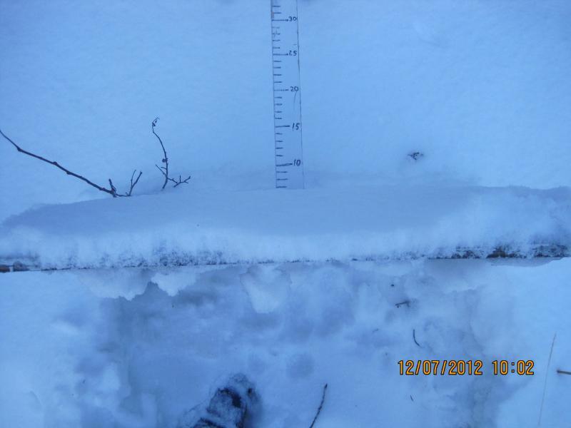
the interval board tells the story
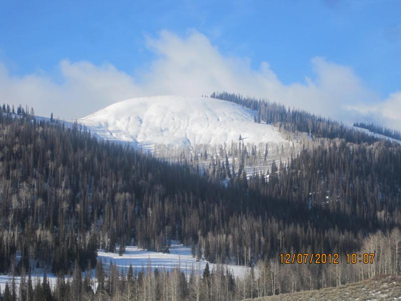
a look at the Big Meadow
Video
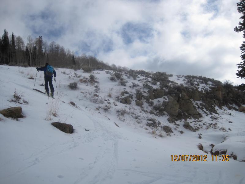
Pretty boney on southern aspects
Coordinates