I investigated four human-triggered avalanches from yesterday in Cardiff Fork. All four failed 12–18 inches deep on a thin weak layer situated 4–5 inches above a thick melt-freeze crust. In the photo below, this older crust—formed during recent weeks of warm temperatures—appears as a dark gray line beneath roughly 20 inches of recent storm snow.
Yesterday’s avalanche activity was significant, featuring remote triggers, wide propagation, and fractures breaking far downslope. The forecast team has been working to verify if facets were the culprit. While cold snow falling on a warm surface can create a steep temperature gradient and cause rapid faceting, my observations at the crowns indicate otherwise. The weak layer primarily consists of decomposing and fragmented snowflakes, rather than facets. While avalanche activity was quieter today, the layer remained reactive in stability tests with several unstable ECTp results.
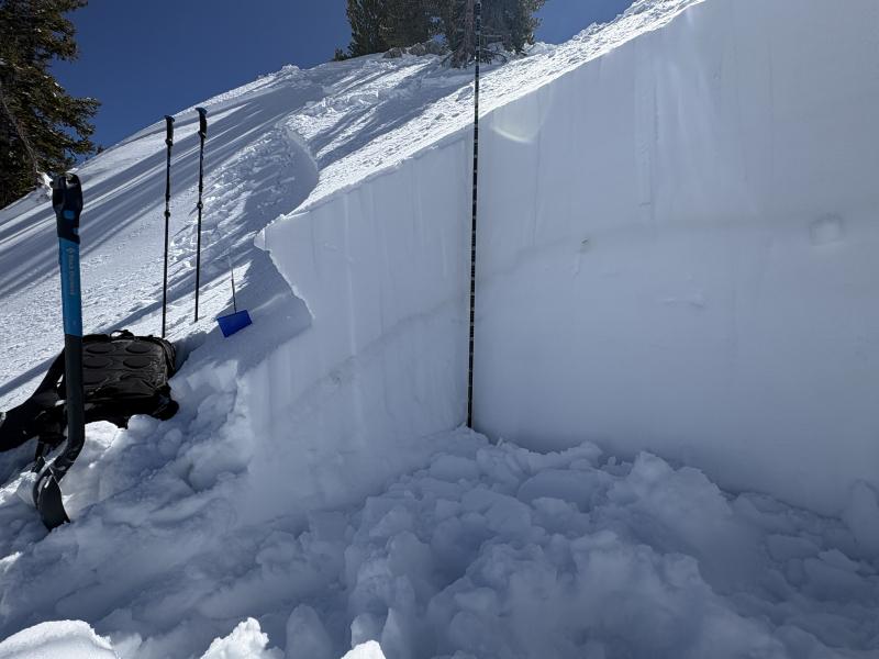
Crown profile of a human-triggered avalanche between Powerline and Cardiff Peak.

Photo of the grains where the avalanche failed.


