Observation: Alta Periphery

Observation Date
4/3/2026
Observer Name
Maushund
Region
Salt Lake » Little Cottonwood Canyon » Alta Periphery
Location Name or Route
Alta Periphery > Brighton
Weather
Sky
Scattered
Wind Direction
Northwest
Wind Speed
Light
Weather Comments
Many periods of partly cloudy skies with lots of sunshine, mixed in with low-hanging clouds that moved in and out of drainages throughout the day. Winds remained calm to light out of the NW. The air was heavy, dense, and moist in the morning. Temps were below freezing, however the solar input from the afternoon sun definitely made an impact on the storm snow.
Snow Characteristics
New Snow Depth
6"
New Snow Density
Medium
Snow Surface Conditions
Powder
Dense Loose
Melt-Freeze Crust
Red Flags
Red Flags
Recent Avalanches
Wind Loading
Cracking
Collapsing
Rapid Warming
Avalanche Problem #1
Problem
Wind Drifted Snow
Problem #1 Comments

Traveling throughout the backcountry near Alta for most of the day before exiting to Brighton, I saw more small to large (D1-D2) avalanches than I could count (head to the Observations page HERE to see reports on many of these). These all were soft slab avalanches of wind-drifted snow that primarily broke on the density change in the snow between the 4/1 and 4/2 storms. They predominantly were on the leeward sides of ridges, however some slides, like the one on Sunset Peak, released sympathetically mid-slope, out the wind zone and propagated widely.

Poking into the crown of 4 different skier-triggered wind slab avalanches, they all appeared to run on the interface between the 4/1 and 4/2 storms. In most areas in upper elevations (and in all crowns I looked into), this was a layer that had warmed up during the greenhousing on 4/1, then refrozen, before being buring by the snow/graupel mix on 4/2. The 4/2 storm snow was primarily a soft slab, and ran on DF and stellars on top of this crust where it existed. Despite cold temps, however, the 4/2 snow was starting to slab up in the afternoon due to solar input.

Avalanche Problem #2
Problem
Wet Snow
Problem #2 Comments

There was no notable wet activity I observed. However, as I watched wind slab avalanches peel off the mid-storm-4/1-4/2-interface, and observed the 4/2 storm snow continually slabbing up during the day with solar input despite cold temps, it is hard to not imagine wet snow avalanches becoming a real problem tomorrow as temps shoot up for the first time since the storm.

Comments

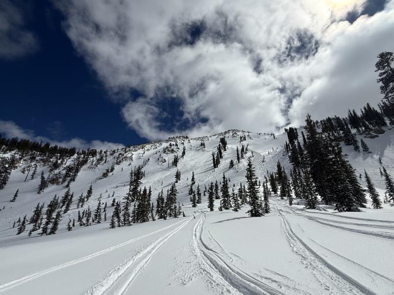
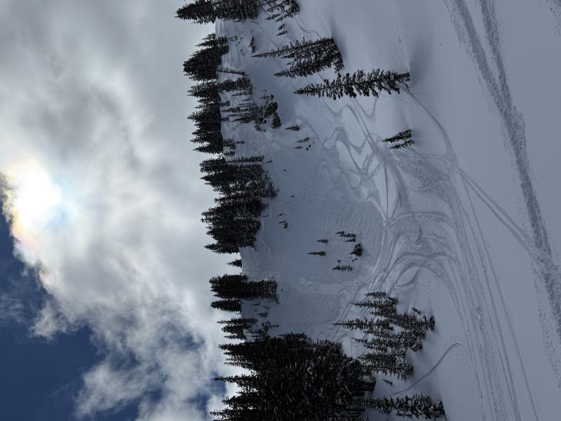
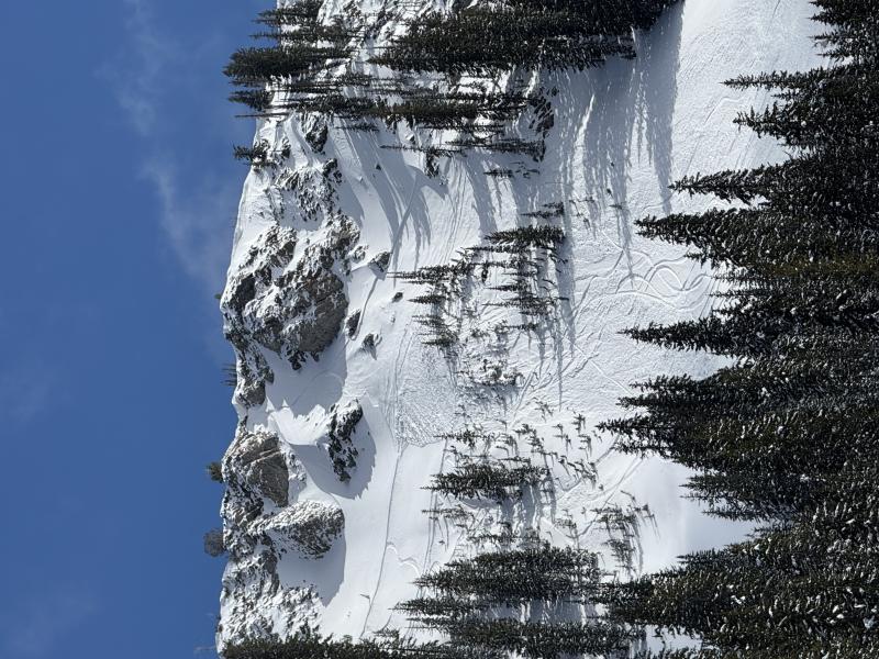
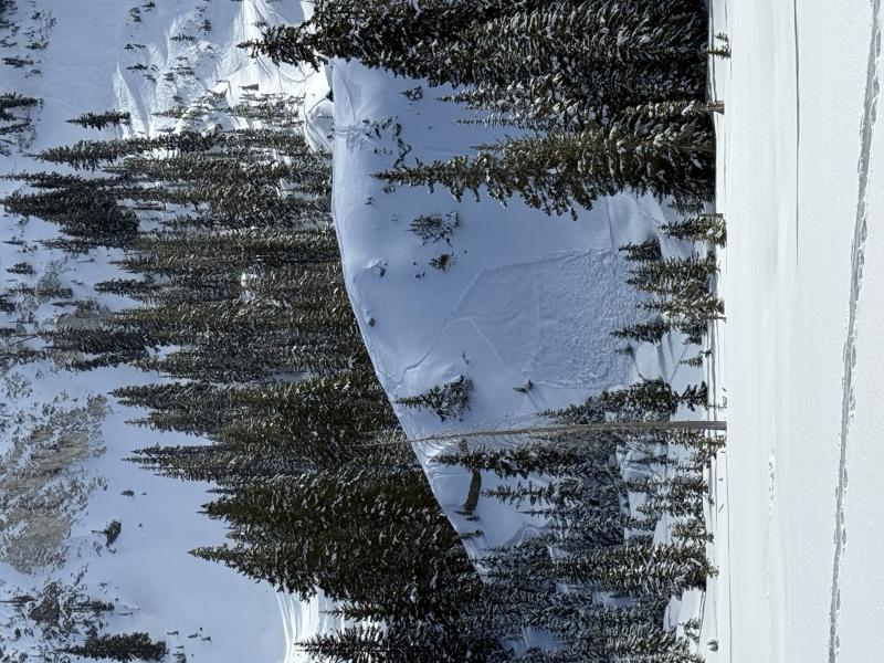
While many of these avalanches can be found on the Observations page, I think it paints a picture how many skier-triggered slides one could see in a relatively short tour distance yesterday.

Photos:

#1: The Sunset Peak avalanches. See Nikki's observation here.

#2: Near Lower Wolverine Chutes

#3: Pioneer Peak.

#4: Near Dog Lake.

Today's Observed Danger Rating
Considerable
Tomorrows Estimated Danger Rating
Considerable
Coordinates