Travels in the Bloomington ecosystem reveal three snowpacks: one is the stark dirt and patchy snow setup below about 6800’, the second features runnels, wet snow as of today, and a snowpack on solars (about 7300’), and the third was observed to have a snowpack depth ranging from 2-2.5m above about 7800’. The differences in the elevation dependent snowpack are striking.
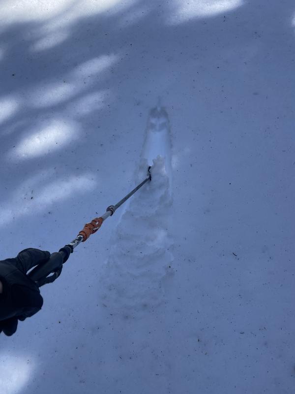
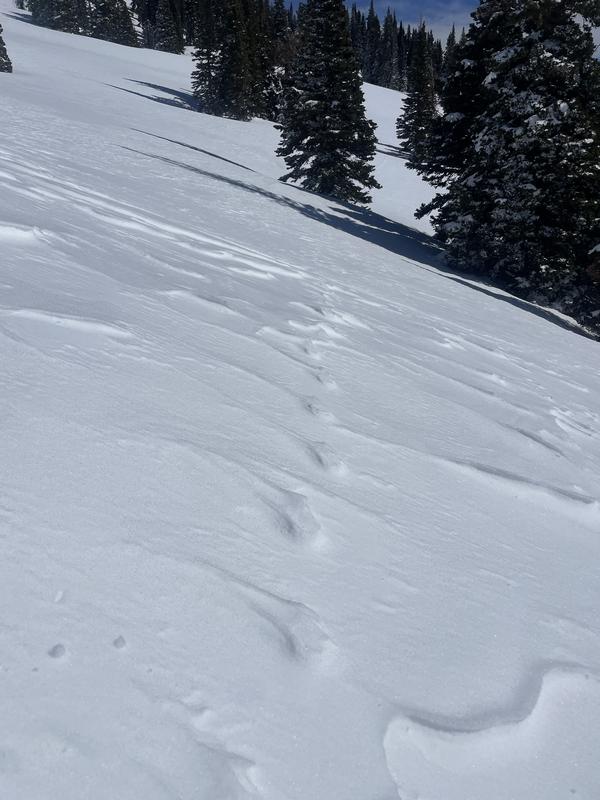
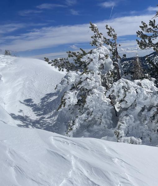
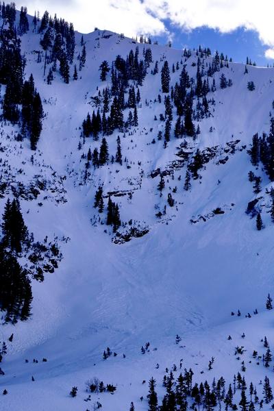
By 1300 hour, snow could be entrained on N at 7800’ (attached photo of pole drag test). However, up higher throughout the day the snow surface stayed cold as a result of strong SW winds (attached photo of raised animal tracks), and rime can still be found frozen to trees on SW (attached). A photo of a steep north facing slope at 8500’ tells the tale of avalanche hazard. Older activity from the most recent storm can be seen in the middle of steep unsupported terrain, with roller balls all around from the past two days’ warm temps (attached). No other avalanche activity was viewed around the area, even at distance through glass.